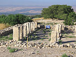
Ayelet HaShahar
1910s establishments in Ottoman Syria1915 establishments in the Ottoman EmpireJewish villages in the Ottoman EmpireKibbutz MovementKibbutzim ... and 3 more
Populated places established in 1915Populated places in Northern District (Israel)Upper Galilee Regional Council

Ayelet HaShahar (Hebrew: אַיֶּלֶת הַשַּׁחַר) is a kibbutz in northern Israel acquired in 1892 and settled in the second Aliyah, located on the Korazim Plateau, by the Rosh Pina – Metulla road, it is approximately 35 kilometres (22 mi) south of Kiryat Shmona and falls under the jurisdiction of Upper Galilee Regional Council. In 2021, it had a population of 1,138. Named after the introduction of Psalm 22, and means "hind of the dawn".
Excerpt from the Wikipedia article Ayelet HaShahar (License: CC BY-SA 3.0, Authors, Images).Ayelet HaShahar
Galil Elyon Regional Council
Geographical coordinates (GPS) Address Nearby Places Show on map
Geographical coordinates (GPS)
| Latitude | Longitude |
|---|---|
| N 33.022777777778 ° | E 35.5775 ° |
Address
Galil Elyon Regional Council
North District, Israel
Open on Google Maps


