place

Lyndhurst, Virginia

Census-designated places in Augusta County, Virginia
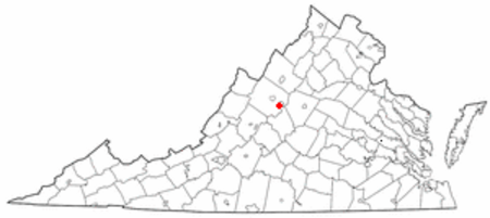
VAMap doton Lyndhurst

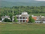
Lyndhurst is a census-designated place (CDP) in Augusta County, Virginia, United States. The population was 1,490 at the 2010 census. It is part of the Staunton–Waynesboro Micropolitan Statistical Area.

Excerpt from the Wikipedia article Lyndhurst, Virginia (License: CC BY-SA 3.0, Authors, Images).

Lyndhurst, Virginia
Pond Lane,

Geographical coordinates (GPS) Address Nearby Places
placeShow on map

Wikipedia: Lyndhurst, VirginiaContinue reading on Wikipedia

Geographical coordinates (GPS)

Latitude Longitude
N 38.026388888889 ° E -78.951388888889 °
placeShow on map

Address

Pond Lane 90
24477
Virginia, United States
mapOpen on Google Maps

VAMap doton Lyndhurst
Share experience

Nearby Places

Virginia
Virginia

Virginia, officially the Commonwealth of Virginia, is a state in the Mid-Atlantic and Southeastern regions of the United States between the Atlantic Coast and the Appalachian Mountains. The state's capital is Richmond. Its most populous city is Virginia Beach, though its most populous subdivision is Fairfax County. Virginia's population in 2022 was over 8.68 million; slightly over a third, 35%, were in the Washington metropolitan area. The Blue Ridge Mountains cross the western and southwestern parts of the state. The state's central region lies predominantly in the Piedmont. Eastern Virginia is part of the Atlantic Plain. The Middle Peninsula forms the mouth of the Chesapeake Bay. Virginia's history begins with several Indigenous groups, including the Powhatan. In 1607, the London Company established the Colony of Virginia as the first permanent English colony in the New World. Virginia's state nickname, the Old Dominion, is a reference to this status. Slave labor and land from displaced native tribes fueled the growing plantation economy, but also fueled conflicts both inside and outside the colony. Virginia was one of the original Thirteen Colonies in the American Revolution and several key battles were fought there during that war. More major battles were fought in Virginia during the American Civil War, which split the state as the government in Richmond joined the Confederacy, but many northwestern counties remained loyal to the Union, which led to the separation of West Virginia from the state in 1863. Although the state was under one-party rule for nearly a century following the Reconstruction era, both major political parties have been competitive in Virginia since the repeal of Jim Crow laws in the 1970s. Virginia's state legislature is the Virginia General Assembly, which was established in July 1619, making it the oldest current law-making body in North America. It is made up of a 40-member Senate and a 100-member House of Delegates. Unlike other states, cities and counties in Virginia function as equals, but the state government manages most local roads inside each. It is the only state where governors are prohibited from serving consecutive terms. Virginia's economy is diverse. The Shenandoah Valley has a strong agricultural sector. Northern Virginia has high technology companies and U.S. federal government agencies, including the U.S. Department of Defense and Central Intelligence Agency, while Hampton Roads, the site of the region's main seaport, has a significant military sector.

Tree Streets Historic District (Waynesboro, Virginia)

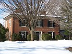
The Tree Streets Historic District is a 120-acre (49 ha) historic district in Waynesboro, Virginia. The aptly named district contains portions of Cherry, Chestnut, Locust, Maple, Oak, Pine and Walnut Avenues as well as portions of Eleventh through Sixteenth Streets and part of South Wayne Avenue. It covers the oldest residential neighborhood in Waynesboro, and reflects the various stages of development of the city from the 19th century through 1951. It was listed on the National Register of Historic Places in 2002. In 2002, it included 445 buildings deemed to contribute to the historic character of the area, two contributing sites, and seven other contributing structures.The oldest structure in the district is the Old Stone House, on Oak Avenue overlooking the South River. The age of the house is uncertain, with estimates ranging from the mid-18th century through the early 19th century. Though it has been extensively renovated at least twice, it retains the original 18-inch-thick (460 mm) fieldstone walls, chimneys at each end and some examples of original woodwork within. On the same property sometime before 1866, the neighboring Rose Cliff was erected. The two-story brick Rose Cliff was the plantation house for a large farm and orchard. In 2006, it was listed separately in the National Register of Historic Places for its architectural significance. About 1890, development was begun in earnest by the successful Waynesboro Company. Early development of this era included Queen Anne style residences like the W.J. Whitaker House at 517 Walnut Avenue and the Fry House at 428 Maple Avenue. The Fry House was designed by architect Carrington Hubbard, and the Whitaker House seems to be a variation of his design. Similarities between the two houses are many, including bay windows, balconies, patterned spandrels and reeded window surrounds while differences include the Fry House's octagonal turret and the Whitaker House's front door transom window. Related groupings of houses such as these were common during this period of development. Another feature indicative of development at this time is "a circular gable vent with a chrysanthemum-like piercing pattern", like the one at 353-357 Chestnut Avenue.