place

Eagle's Nest Airport (Virginia)

Airports in VirginiaBuildings and structures in Augusta County, VirginiaSouthern United States airport stubsTransportation in Augusta County, VirginiaVirginia building and structure stubs
Virginia transportation stubs

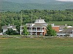
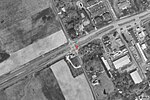
Waynesboro Eagle's Nest Airport (FAA LID: W13) is a public-use airport located three miles (5 km) west of the central business district of Waynesboro, in Augusta County, Virginia, United States. It is privately owned by Michael L. Fogle.

Excerpt from the Wikipedia article Eagle's Nest Airport (Virginia) (License: CC BY-SA 3.0, Authors).

Eagle's Nest Airport (Virginia)
P 38 Drive,

Geographical coordinates (GPS) Address External links Nearby Places
placeShow on map

Wikipedia: Eagle's Nest Airport (Virginia)Continue reading on Wikipedia

Geographical coordinates (GPS)

Latitude Longitude
N 38.076944444444 ° E -78.944166666667 °
placeShow on map

Address

Eagles Nest Airport

P 38 Drive
22980
Virginia, United States
mapOpen on Google Maps

linkWikiData (Q5324975)
linkOpenStreetMap (816954400)

Share experience

Nearby Places

Tree Streets Historic District (Waynesboro, Virginia)

The Tree Streets Historic District is a 120-acre (49 ha) historic district in Waynesboro, Virginia. The aptly named district contains portions of Cherry, Chestnut, Locust, Maple, Oak, Pine and Walnut Avenues as well as portions of Eleventh through Sixteenth Streets and part of South Wayne Avenue. It covers the oldest residential neighborhood in Waynesboro, and reflects the various stages of development of the city from the 19th century through 1951. It was listed on the National Register of Historic Places in 2002. In 2002, it included 445 buildings deemed to contribute to the historic character of the area, two contributing sites, and seven other contributing structures.The oldest structure in the district is the Old Stone House, on Oak Avenue overlooking the South River. The age of the house is uncertain, with estimates ranging from the mid-18th century through the early 19th century. Though it has been extensively renovated at least twice, it retains the original 18-inch-thick (460 mm) fieldstone walls, chimneys at each end and some examples of original woodwork within. On the same property sometime before 1866, the neighboring Rose Cliff was erected. The two-story brick Rose Cliff was the plantation house for a large farm and orchard. In 2006, it was listed separately in the National Register of Historic Places for its architectural significance. About 1890, development was begun in earnest by the successful Waynesboro Company. Early development of this era included Queen Anne style residences like the W.J. Whitaker House at 517 Walnut Avenue and the Fry House at 428 Maple Avenue. The Fry House was designed by architect Carrington Hubbard, and the Whitaker House seems to be a variation of his design. Similarities between the two houses are many, including bay windows, balconies, patterned spandrels and reeded window surrounds while differences include the Fry House's octagonal turret and the Whitaker House's front door transom window. Related groupings of houses such as these were common during this period of development. Another feature indicative of development at this time is "a circular gable vent with a chrysanthemum-like piercing pattern", like the one at 353-357 Chestnut Avenue.