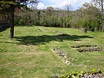
Llangynin
Carmarthenshire geography stubsCommunities in CarmarthenshireVillages in Carmarthenshire

Llangynin is a village and community located in Carmarthenshire, Wales. The Welsh language name of the village means "the church of St. Cynin" The population of the community taken at the 2011 census was 284.St Cynin's church is a grade II* listed building which stands some 2 km south of the centre of the village.The community is bordered by the communities of: Llanwinio; Meidrim; St Clears; and Llanboidy, all being in Carmarthenshire.
Excerpt from the Wikipedia article Llangynin (License: CC BY-SA 3.0, Authors, Images).Llangynin
Geographical coordinates (GPS) Address Nearby Places Show on map
Geographical coordinates (GPS)
| Latitude | Longitude |
|---|---|
| N 51.85 ° | E -4.55 ° |
Address
SA33 4LA , Llangynin
Wales, United Kingdom
Open on Google Maps


