place

Downtown Markham, Ontario

Central business districts in CanadaNeighbourhoods in Markham, OntarioProposed populated places
Downtown Markham view from Hwy 407 2023

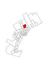
Downtown Markham is the main central business district of Markham, Ontario, Canada. Currently under development, it is located within Markham Centre near the historic Unionville district and is proposed to serve as the heart of Markham. Businesses in the district are expected to employ up to 16,000 individuals, and it may house as many as 10,000 residents. The development plans will have a high density of residential, retail, commercial and mixed-use structures. The community is being developed, built and wholly financed by The Remington Group Inc.

Excerpt from the Wikipedia article Downtown Markham, Ontario (License: CC BY-SA 3.0, Authors, Images).

Downtown Markham, Ontario
Enterprise Boulevard, Markham

Geographical coordinates (GPS) Address Nearby Places
placeShow on map

Wikipedia: Downtown Markham, OntarioContinue reading on Wikipedia

Geographical coordinates (GPS)

Latitude Longitude
N 43.85 ° E -79.32 °
placeShow on map

Address

Enterprise Boulevard

Enterprise Boulevard
L6G 1B3 Markham
Ontario, Canada
mapOpen on Google Maps

Downtown Markham view from Hwy 407 2023
Share experience

Nearby Places

Hagerman's Corners, Ontario

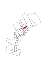
Hagerman's Corners is a dispersed rural community in Markham, Ontario, Canada. Located at 14th Avenue and Kennedy Road, the former farm lands have disappeared and given way to homes and commercial parks. It is geographically located between the communities of Milliken Mills and Unionville, within the city of Markham. Hagerman's Corners was founded in 1803 by Nicholas Hagerman, who owned the property at the NW corner of the intersection. By 1878 the village had a hotel (Bee Hive Hotel) and tavern, a general store and post office (1873), and a wagon maker. In 1849, a Wesleyan Methodist church was built on a private Hagerman family burying ground; the wood-frame church was replaced by a brick building in 1874. While the church was torn down in the 1920s, the cemetery on the east side of Kennedy Road (on James Fairless' farm), north of 14th Avenue remains with former Presbyterian church demolished. A few historical homes still exist and have been revitalized in an attempt to beautify the area. Today, the west side of Kennedy Road is home to a new public housing project for the city of Markham. Two small strip malls with mostly Chinese stores are located on the southwest corner of 14th Avenue and Kennedy Road. One of the shopping areas houses the First Choice Supermarket, a Chinese-based supermarket (formerly Big Land Farm) and Tim Hortons; the other is home to various Asian restaurants. Hagerman Mennonite Church has met in the village since 1932.

Unionville, Ontario
Unionville, Ontario

Unionville is a suburban district and former village in Markham, Ontario, Canada, 2 km (2.5 mi) west of Markham Village (the City of Markham's historic downtown), and 33 km (20.5 mi) northeast of Downtown Toronto. The boundaries of Unionville are not well-defined. Several neighbourhoods claim to be part of it however, this has been disputed between the various wards.Unionville was founded north of 16th Avenue in 1794, and many of the farms on and around Kennedy Road. The Unionville Ratepayers Association designated a newer street, Rodick Road, as its western boundary, in the 1980s. Main Street Unionville, which was Kennedy Road in the mid-to-late 20th century, runs through Unionville while the new Kennedy Road runs 300 metres (330 yd) to the east. Rouge River runs north of the central part of Unionville and to the southeast. Highway 404 is to the west, with the nearest interchange with Highway 407 is 2 kilometres (1.2 mi) south on Kennedy Road. Unionville is predominantly residential except for the south central industrial area, which is slated for massive intensification. Tourism is a major part of Unionville's economy. The village itself still resembles the small town that developed over a century or so starting in the early 1840s (when Ira White erected his Union Mills) through the middle to late 20th century. Now a 'heritage conservation district', it attracts thousands of visitors each year — as of 2006 it boasted nine restaurants, including three pubs. Main Street (originally the laneway from the village's first grist mill) also has a number of "century homes" dating back to the 19th century. Each year, thousands of people visit Unionville during the Unionville Festival.The main street has been a stand-in for fictional Connecticut town Stars Hollow during the first season of Gilmore Girls television show, and for other television and movie backdrops. Most of the historic buildings in Unionville are included in List of historic buildings in Markham, Ontario.