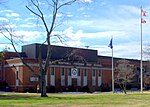
West End (Richmond, Virginia)
Neighborhoods in Richmond, VirginiaVague or ambiguous time from March 2015

The West End is a part of Richmond, Virginia. Definitions of the bounds of the West End vary, it may include only the western part of the city of Richmond or extend as far as western Henrico County. As there is no one municipal organization that represents this specific region, the boundaries are loosely defined as being north of the James River, west of I-195, and south of Broad Street. Historically, the Richmond neighborhoods of the Fan and the Museum District were a part of the West End. A primary conduit through the West End is Interstate 64.
Excerpt from the Wikipedia article West End (Richmond, Virginia) (License: CC BY-SA 3.0, Authors, Images).West End (Richmond, Virginia)
Nesslewood Road,
Geographical coordinates (GPS) Address Nearby Places Show on map
Geographical coordinates (GPS)
| Latitude | Longitude |
|---|---|
| N 37.621111111111 ° | E -77.558333333333 ° |
Address
Nesslewood Road 8640
23229
Virginia, United States
Open on Google Maps


