Frome Valley Walkway

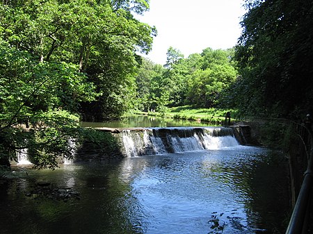
The Frome Valley Walkway is an 18-mile (29 km) footpath which follows the River Frome from the River Avon in the centre of Bristol to the Cotswold Hills in South Gloucestershire. The path also links the Cotswold Way National Trail at one end with the Avon Walkway at the other. Starting in Bristol's Castle Park, the path skirts public parks in the city, where the river is culverted, and only becomes rural as it passes through Eastville Park. The walk then continues past Snuff Mills and on to the Oldbury Court Estate, passing beneath Frenchay Common, then to Cleeve Bridge before passing under the M4 motorway at Hambrook. Next, the path passes through Winterbourne Down, and under the Winterbourne Viaduct. The path continues through parkland to Frampton Cotterell, then south of Iron Acton before it reaches Yate and the Goose Green Fields Nature Area. A large section of the walkway is along suburban pavement here, before the final stretch of fields leading to Old Sodbury where the Walkway officially stops. It is, however, possible to continue along the Cotswold Way to Tormarton, past the source of the Frome, where there are views from the top of the escarpment.
Excerpt from the Wikipedia article Frome Valley Walkway (License: CC BY-SA 3.0, Authors, Images).Frome Valley Walkway
Broom Hill, Bristol Stapleton
Geographical coordinates (GPS) Address Nearby Places Show on map
Geographical coordinates (GPS)
| Latitude | Longitude |
|---|---|
| N 51.485 ° | E -2.548 ° |
Address
Broom Hill 1
BS16 1DH Bristol, Stapleton
England, United Kingdom
Open on Google Maps


