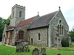
Monk Soham

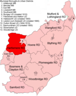
Monk Soham is a village in Suffolk, eastern England, four miles (6.4 km) northeast of Debenham and six miles (10 km) northwest of Framlingham. The neighbouring villages are Bedfield, Ashfield cum Thorpe, Kenton and Bedingfield. The nearest primary school is in Bedfield. There are secondary schools in Framlingham, Debenham and Woodbridge.In 2011, Monk Soham had a population of 156.In the early 1870s, Monk Soham was described as a parish, with a village, in Hoxne district, Suffolk; four and a quarter miles WNW of Framlingham r. station. Post town, Wickham-Market. Acres, 1,569. Real property, £3,153. Pop., 442. Houses, 86. The property is subdivided. The living is a rectory in the diocese of Norwich. Value, £530. There are a parochial school, and charities £80.
Excerpt from the Wikipedia article Monk Soham (License: CC BY-SA 3.0, Authors, Images).Monk Soham
School Road, Mid Suffolk
Geographical coordinates (GPS) Address Nearby Places Show on map
Geographical coordinates (GPS)
| Latitude | Longitude |
|---|---|
| N 52.239495 ° | E 1.241331 ° |
Address
School Road
IP13 7EW Mid Suffolk
England, United Kingdom
Open on Google Maps


