place

Prudence Crandall Museum

1805 establishments in ConnecticutAfrican-American history of ConnecticutBiographical museums in ConnecticutCanterbury, ConnecticutDefunct schools in Connecticut
Historic American Buildings Survey in ConnecticutHistoric district contributing properties in ConnecticutHistoric house museums in ConnecticutHouses completed in 1805Houses in Windham County, ConnecticutHouses on the National Register of Historic Places in ConnecticutMuseums in Windham County, ConnecticutNRHP infobox with nocatNational Historic Landmarks in ConnecticutNational Register of Historic Places in Windham County, ConnecticutPrudence CrandallSchools in Windham County, ConnecticutTourist attractions in Windham County, ConnecticutUse mdy dates from August 2023Women's museums in Connecticut
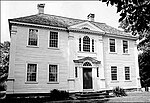
Prudence Crandall House, Canterbury CT

The Prudence Crandall Museum is a historic house museum, sometimes called the Elisha Payne House for its previous owner. It is located on the southwest corner of the junction of Connecticut Routes 14 and 169, on the Canterbury, Connecticut village green. It is designated a U.S. National Historic Landmark as Prudence Crandall House.

Excerpt from the Wikipedia article Prudence Crandall Museum (License: CC BY-SA 3.0, Authors, Images).

Prudence Crandall Museum
South Canterbury Road,

Geographical coordinates (GPS) Address Nearby Places
placeShow on map

Wikipedia: Prudence Crandall MuseumContinue reading on Wikipedia

Geographical coordinates (GPS)

Latitude Longitude
N 41.697916666667 ° E -71.971944444444 °
placeShow on map

Address

South Canterbury Road 5
06331
Connecticut, United States
mapOpen on Google Maps

Prudence Crandall House, Canterbury CT
Share experience

Nearby Places

March Route of Rochambeau's Army: Manship Road-Barstow Road

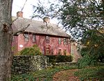
March Route of Rochambeau's Army: Manship Road-Barstow Road is a historic site in Canterbury, Connecticut that was listed on the National Register of Historic Places in 2003, for its evocation of the march route French commander Rochambeau's troops in 1781 and in 1782. It is significant as a preserved section of the march route which, in this area, is followed by what is now Connecticut Route 14. This section, however, is a bypassed loop of road, cut off by a road realignment in the 1930s, and therefore without traffic and not modernized. The section is approximately 1,400 feet of bypassed loop of road, on the north side of the main road, along Manship Road and Barstow Road, starting from a junction of the loop with Manship Road and running to Westminster Road. It is paved road about 20 feet wide, plus a margin to stone walls lining the road. The designated area is about 50 to 55 feet wide, extending to the walls. The National Register nomination of 2001 includes six photos of narrow roadway, stone walls, and the one house along this section. The house is itself historical, dating from about the 1840s, and adds rather than detracts from the historical feel.Rochambeau's troops marched through here in June, 1781, and found the road along this general area to be the most difficult along their whole journey. Although the road has been paved, the visual appearance is still evocative of passage of troops.Other preserved sections of the route nearby include March Route of Rochambeau's Army: Old Canterbury Road (about 2 miles (3.2 km) to the east, along Route 14 through Canterbury then straight on 14A, Canterbury Road) and March Route of Rochambeau's Army: Palmer Road (an approximately 2,000-foot (610 m) stretch about 3 miles (4.8 km) to the west along Route 14). Multiple other properties whose association with Rochambeau's route is known were also considered for listing on the National Register in a 2001 study.

Central Village Historic District

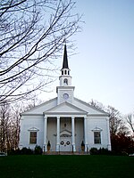
The Central Village Historic District is a historic district in the Central Village area of Plainfield, Connecticut that was listed on the National Register of Historic Places (NRHP) in 1991. It encompasses a late 19th-century historic mill village, including a small commercial center where Connecticut Route 12 and 14 meet, a cluster of architecturally distinguished buildings built by mill owners and managers, and a collection of mill worker housing units. It includes the Plainfield Woolen Company Mill, which is separately listed, as well as archaeological remnants of other mill infrastructure. It also includes Plainfield's old town hall (built 1872) and high school (built 1924). Other architecturally prominent buildings include the c. 1855 Italianate mansion of mill owner Arthur Fenner, and the 1845 Greek Revival Congregational Church.The area that is now Central Village was a typical agricultural area until 1814, when a consortium of locals built a small cotton mill on the banks of the Moosup River. This enterprise gradually expanded, with the owners building housing for the mill workers, creating a small village. In 1845 the Central Manufacturing Company, then the village's largest employer, built a brick mill. The village's growth was encouraged by the arrival of the railroad in 1839, which was run midway between two mill locations. The cotton mills declined in the late 19th century, but its economy was propped up by other industries until the early 20th century, when the Plainfield Woolen Company revived the textile industry, building the principal surviving mill building.