place

Wauregan, Connecticut

Census-designated places in ConnecticutCensus-designated places in Windham County, ConnecticutHistoric districts in Windham County, ConnecticutHistory of the textile industryNRHP infobox with nocat
Plainfield, ConnecticutUse mdy dates from July 2023Villages in Windham County, Connecticut
Wauregan Mill Village

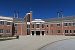
Wauregan is a village located in the northwestern corner of the town of Plainfield, Connecticut in the United States. Originally a mill village, Wauregan was established around a cotton mill powered by the Quinebaug River. Wauregan and West Wauregan, across the Quinebaug in the town of Brooklyn, together comprise the Wauregan census-designated place, with a population of 1,205 at the 2010 census.A 90-acre (360,000 m2) portion of the original village area is listed as a historic district, the Wauregan Historic District, encompassing structures that are directly related to the economic and social activities of the mill. The district was listed on the National Register of Historic Places in 1979. Extant buildings in the Wauregan historic district include the Wauregan Mill, an H-shaped building built from local fieldstone; James Atwood's home; the two boarding houses; the company store; and over one hundred workers' houses. Architectural styles represented include Greek Revival and Late Victorian architecture.

Excerpt from the Wikipedia article Wauregan, Connecticut (License: CC BY-SA 3.0, Authors, Images).

Wauregan, Connecticut
Front Street,

Geographical coordinates (GPS) Address Nearby Places
placeShow on map

Wikipedia: Wauregan, ConnecticutContinue reading on Wikipedia

Geographical coordinates (GPS)

Latitude Longitude
N 41.743888888889 ° E -71.910555555556 °
placeShow on map

Address

Front Street 8
06374
Connecticut, United States
mapOpen on Google Maps

Wauregan Mill Village
Share experience

Nearby Places

Central Village Historic District

The Central Village Historic District is a historic district in the Central Village area of Plainfield, Connecticut that was listed on the National Register of Historic Places (NRHP) in 1991. It encompasses a late 19th-century historic mill village, including a small commercial center where Connecticut Route 12 and 14 meet, a cluster of architecturally distinguished buildings built by mill owners and managers, and a collection of mill worker housing units. It includes the Plainfield Woolen Company Mill, which is separately listed, as well as archaeological remnants of other mill infrastructure. It also includes Plainfield's old town hall (built 1872) and high school (built 1924). Other architecturally prominent buildings include the c. 1855 Italianate mansion of mill owner Arthur Fenner, and the 1845 Greek Revival Congregational Church.The area that is now Central Village was a typical agricultural area until 1814, when a consortium of locals built a small cotton mill on the banks of the Moosup River. This enterprise gradually expanded, with the owners building housing for the mill workers, creating a small village. In 1845 the Central Manufacturing Company, then the village's largest employer, built a brick mill. The village's growth was encouraged by the arrival of the railroad in 1839, which was run midway between two mill locations. The cotton mills declined in the late 19th century, but its economy was propped up by other industries until the early 20th century, when the Plainfield Woolen Company revived the textile industry, building the principal surviving mill building.