Kensington Canal

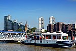
The Kensington Canal was a canal, about two miles long, opened in 1828 in London from the River Thames on the parish boundary between Chelsea and Fulham, along the line of Counter's Creek, to a basin near Warwick Road in Kensington. It had one lock near the Kensington Basin and wharves on the Fulham side, south of Lillie bridge. It was not commercially successful, and was purchased by a railway company, which laid a line along the route of the canal on the Fulham side. A second railway line followed in the filled-in littoral of the canal, thus one became London Underground's Wimbledon branch and the other, the West London Line.
Excerpt from the Wikipedia article Kensington Canal (License: CC BY-SA 3.0, Authors, Images).Kensington Canal
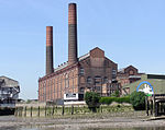
Lots Road, London World's End (Royal Borough of Kensington and Chelsea)
Geographical coordinates (GPS) Address Nearby Places Show on map
Geographical coordinates (GPS)
| Latitude | Longitude |
|---|---|
| N 51.4772 ° | E -0.1844 ° |
Address
Lots Road Car Pound
Lots Road 60
SW10 0TZ London, World's End (Royal Borough of Kensington and Chelsea)
England, United Kingdom
Open on Google Maps


