Holland

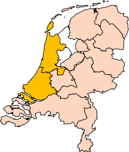
Holland is a geographical region and former province on the western coast of the Netherlands. From the 10th to the 16th century, Holland proper was a unified political region within the Holy Roman Empire as a county ruled by the counts of Holland. By the 17th century, the province of Holland had risen to become a maritime and economic power, dominating the other provinces of the newly independent Dutch Republic. The area of the former County of Holland roughly coincides with the two current Dutch provinces of North Holland and South Holland into which it was divided, and which together include the Netherlands' three largest cities: the capital city (Amsterdam), the home of Europe's largest port (Rotterdam), and the seat of government (The Hague). Holland has a population of 6,583,534 as of November 2019, and a population density of 1203/km2. The name Holland has frequently been used informally to refer to the whole of the country of the Netherlands. This casual usage is commonly accepted in other countries, and is even employed by many Dutch themselves. However, some in the Netherlands (particularly those from regions outside Holland or the west) find it undesirable or misrepresentative to use the term for the whole country. In January 2020, the Netherlands officially dropped its support of the word Holland for the whole country, which included a logo redesign that changed "Holland" to "NL".
Excerpt from the Wikipedia article Holland (License: CC BY-SA 3.0, Authors, Images).Holland
Venneperweg, Haarlemmermeer
Geographical coordinates (GPS) Address Nearby Places Show on map
Geographical coordinates (GPS)
| Latitude | Longitude |
|---|---|
| N 52.25 ° | E 4.667 ° |
Address
Venneperweg 111A
1435 EZ Haarlemmermeer
North Holland, Netherlands
Open on Google Maps


