Bridgeton Township, Bucks County, Pennsylvania

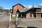
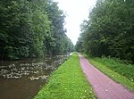
Bridgeton Township is a township in Bucks County, Pennsylvania, United States. The population was 1,277 at the 2010 census. The township was originally a part of adjacent Nockamixon Township, but a division was arranged and signed on May 24, 1890. This accord split an area of Nockamixon which ran west from the banks of the Delaware River to approximately one third the breadth of the original township. This smaller area was named "Bridgeton", as it was the site of Upper Black Eddy-Milford Bridge covered wooden truss bridge built in 1842, which connected the towns of Upper Black Eddy and Milford, New Jersey. The original covered bridge was replaced by a truss bridge in 1933. The township originally contained several tiny hamlets, such as the aforementioned Upper Black Eddy, Narrowsville, and Rupletown. Upper Black's Eddy, as it was originally called, and Raubsville were named for notable landholders, while Narrowsville was named for a particularly thin portion of the Delaware River. With the construction of a centralized post office in Upper Black Eddy, the usage of separate names for the smaller towns ceased in an official capacity, and the everyday errands of residents became centered on the largest of the towns. What little commercial trade exists in the township is now centered solely in Upper Black Eddy, with any evidence of there being any distinctive, smaller villages existing only on outdated road-signs and maps. Ringing Rocks Park is located within the township, as well as state game hunting lands. Bridgeton Township is also home to the Homestead General Store, the oldest continually operating general store on the Delaware Canal.
Excerpt from the Wikipedia article Bridgeton Township, Bucks County, Pennsylvania (License: CC BY-SA 3.0, Authors, Images).Bridgeton Township, Bucks County, Pennsylvania
Chestnut Ridge Road, Bridgeton Township
Geographical coordinates (GPS) Address Nearby Places Show on map
Geographical coordinates (GPS)
| Latitude | Longitude |
|---|---|
| N 40.558055555556 ° | E -75.110277777778 ° |
Address
Chestnut Ridge Road
Chestnut Ridge Road
18972 Bridgeton Township
Pennsylvania, United States
Open on Google Maps


