Cedar Hills, Oregon

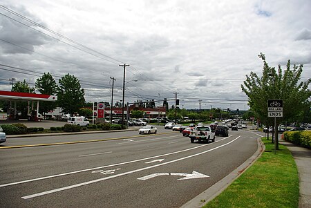
Cedar Hills is a census-designated place and neighborhood in Washington County, Oregon, United States south of U.S. Route 26 and west of Oregon Route 217 and within the Portland metropolitan area. Constructed starting in 1946, Cedar Hills was the largest single housing tract development in the western United States at the time of its completion in 1961.Cedar Hills is located almost entirely in unincorporated Washington County. In the early 2000s, a small portion of the neighborhood was annexed by the city of Beaverton, mainly comprising one school property and an adjacent community center, and in a plan agreed to by the county and Beaverton the remainder is scheduled for annexation in the future. The formal Cedar Hills neighborhood currently includes 2,114 homes, whose owners are subject to the rules and covenants enforced by the area's homeowners' association, the Homes Association of Cedar Hills.The population was 8,949 at the 2000 census.
Excerpt from the Wikipedia article Cedar Hills, Oregon (License: CC BY-SA 3.0, Authors, Images).Cedar Hills, Oregon
Hintere Zollamtsstraße, Wien Weißgerber (Landstraße)
Geographical coordinates (GPS) Address Nearby Places Show on map
Geographical coordinates (GPS)
| Latitude | Longitude |
|---|---|
| N 45.504722222222 ° | E -122.79833333333 ° |
Address
Bundesimmobiliengesellschaft
Hintere Zollamtsstraße 1
1030 Wien, Weißgerber (Landstraße)
Österreich
Open on Google Maps


