place

Northcote Road

BatterseaStreets in the London Borough of WandsworthUse British English from January 2017
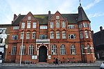
Northcote Road SW11 (4) geograph.org.uk 187108

Northcote Road is a shopping street In Battersea, south London, which stretches over half a mile. It is close to Clapham Junction station. It is the epicentre of the so-called 'Nappy Valley', named because of the young, affluent and productive demographic and also because the road lies over a culverted stream (the Falconbrook) giving it a low-lying position between the two commons of Wandsworth and Clapham (rising to the west and east respectively). As well as many cafes and shops, Northcote Road has an historic food market which dates back to the 1860s, as well as the indoor Northcote Road Antiques Market. However, as with the vast majority of street markets, Northcote Road is a mere shadow of itself, being much smaller size, and more specialised in what its stalls offer, reflecting the changing demographics of the local area.

Excerpt from the Wikipedia article Northcote Road (License: CC BY-SA 3.0, Authors, Images).

Northcote Road
Wakehurst Road, London Clapham Junction (London Borough of Wandsworth)

Geographical coordinates (GPS) Address Nearby Places
placeShow on map

Wikipedia: Northcote RoadContinue reading on Wikipedia

Geographical coordinates (GPS)

Latitude Longitude
N 51.457 ° E -0.165 °
placeShow on map

Address

The Bird Cage

Wakehurst Road
SW11 6BU London, Clapham Junction (London Borough of Wandsworth)
England, United Kingdom
mapOpen on Google Maps

Northcote Road SW11 (4) geograph.org.uk 187108
Share experience

Nearby Places

St Mark's, Battersea Rise

St Mark's, Battersea Rise, is a Victorian Grade II* listed Anglican church located in Clapham Junction in London. The church was designed by William White and built from 1872 to 1874 in a Geometric Middle-pointed, 13th Century Gothic style using yellow bricks with red brick dressings and diapering. Inside, the nave comprises four bays with north aisles, a tower at the south-west corner supporting a wooden belfry and a shingled spire. Concrete piers with naturalistic stone-carved capitals were produced by Harry Hems. The interior floor is tiled. The choir stalls, pulpit and font were built to White's designs. The altar is raised on a stone plinth behind low brass rails. At the east end, the ambulatory descends to the crypt.After a declining congregation and a dilapidated church building, the parish recovered as the result of a church plant in 1987 from Holy Trinity Brompton, led by Pastor Paul Perkin, his wife Christine and a group of about 50 followers. Through donations from the congregation, building works have been undertaken, with a new welcome hall and extended meeting hall opened in 2007. St Mark's Church has been described as conservative and evangelical and was the subject of an article by The Guardian newspaper in 2012, Money becomes new church battleground. The article describes a "bitter power struggle within the CofE and the wider Anglican communion" on conservative issues such as homosexuality and the ordination of women priests. Boutflower Road, which runs to the east of the church, is named for Henry Boutflower Verdon, the church's first vicar-designate who died, young, in 1879, seven years before the construction of the road as part of Alfred Heaver's St John's Park property development.