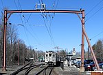
Peapack-Gladstone, New Jersey

Peapack-Gladstone (also written as Peapack and Gladstone) is a borough in the Somerset Hills region of northern Somerset County in the U.S. state of New Jersey. As of the 2020 United States census, the borough's population was 2,558, a decrease of 24 (−0.9%) from the 2010 census count of 2,582, which in turn reflected an increase of 149 (+6.1%) from the 2,433 counted in the 2000 census.Peapack-Gladstone was incorporated as a borough by an act of the New Jersey Legislature on March 28, 1912, from portions of Bedminster, subject to the results of a referendum held on April 23, 1912. It is part of the New York metropolitan area, as well as the larger New York–Newark–Bridgeport, NY-New Jersey-CT-PA Combined Statistical Area and it is located within the Raritan Valley region.Peapack is home to historic Natirar as well as the Essex Hunt Club and Fox Hounds. In operation until the mid-1930s, the Moses Craig Lime Kilns are located at the center of Peapack.Gladstone is home to the Hamilton Farm Golf Club, the Stronghold Soccer Club and the United States Equestrian Team. Gill St. Bernard's School, established in 1900, is a private, nonsectarian, coeducational, college preparatory day school, serving students in pre-kindergarten through twelfth grade, located on a 208-acre (84 ha) campus that straddles the borders of Gladstone and neighboring Chester Township in Morris County.In the Forbes magazine 2017 ranking of the Most Expensive ZIP Codes in the United States, Gladstone was ranked as the 457th most expensive in the country, with its median home sale price of $938,042. In 2018, New Jersey Business Magazine listed Gladstone at 46th in its listing of "The Most Expensive ZIP Codes in New Jersey", with a median sale price 2017 of $627,500.
Excerpt from the Wikipedia article Peapack-Gladstone, New Jersey (License: CC BY-SA 3.0, Authors, Images).Peapack-Gladstone, New Jersey
Untere Hauptstraße, Herxheim
Geographical coordinates (GPS) Address Nearby Places Show on map
Geographical coordinates (GPS)
| Latitude | Longitude |
|---|---|
| N 40.715782 ° | E -74.654054 ° |
Address
Untere Hauptstraße
Untere Hauptstraße
76863 Herxheim
Rheinland-Pfalz, Deutschland
Open on Google Maps


