Wolvercote Common
Areas of OxfordCommon land in EnglandGrasslands of the United KingdomHistory of OxfordParks and open spaces in Oxford ... and 3 more
Parks and open spaces in OxfordshireSites of Special Scientific Interest in OxfordshireWater-meadows

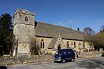
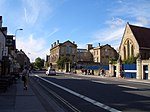
Wolvercote Common is an area of grassed common land north of Port Meadow in Oxford, England.
Excerpt from the Wikipedia article Wolvercote Common (License: CC BY-SA 3.0, Authors, Images).Wolvercote Common
Woodstock Road, Oxford Cutteslowe
Geographical coordinates (GPS) Address Nearby Places Show on map
Geographical coordinates (GPS)
| Latitude | Longitude |
|---|---|
| N 51.784 ° | E -1.286 ° |
Address
Wolvercote
Woodstock Road
OX2 8BZ Oxford, Cutteslowe
England, United Kingdom
Open on Google Maps


