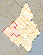
Streetsville, Mississauga

Streetsville (pop. 47,327) is a neighbourhood located in the northwestern corner of the city of Mississauga, Ontario, Canada, on the Credit River. Although Streetsville occupies the west and east banks of the river, the majority is located on the west bank of the river. A town prior to the 1974 amalgamations that formed the City of Mississauga, it seeks to keep a "small town" charm by retaining a variety of historical buildings and streetscapes. As part of this attempt to maintain a separate identity from the larger city, the names of two main Mississauga streets, as they pass through Streetsville, retain the names they had when Streetsville was an independent village: Mississauga Road and Bristol Road, which remain as Queen Street and Main Street respectively. Other main thoroughfares that pass through or near Streetsville include Britannia Road, Creditview Road, Eglinton Avenue, and Erin Mills Parkway.
Excerpt from the Wikipedia article Streetsville, Mississauga (License: CC BY-SA 3.0, Authors, Images).Streetsville, Mississauga
James Street, Mississauga Streetsville
Geographical coordinates (GPS) Address Nearby Places Show on map
Geographical coordinates (GPS)
| Latitude | Longitude |
|---|---|
| N 43.586666666667 ° | E -79.721388888889 ° |
Address
James Street
James Street
L5M 1J2 Mississauga, Streetsville
Ontario, Canada
Open on Google Maps


