place

West Rock Ridge State Park

Climbing areas of the United StatesHamden, ConnecticutMetacomet Ridge, ConnecticutParks in New Haven, ConnecticutParks in New Haven County, Connecticut
Protected areas established in 1975State parks of ConnecticutUse mdy dates from August 2023Woodbridge, Connecticut
N58102886 30611581 9191

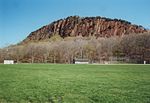
West Rock Ridge State Park is a public recreation area located in New Haven, Hamden, and Woodbridge, Connecticut. The state park is named for the 400-to-700-foot (120 to 210 m) trap rock West Rock Ridge, which is part of the Metacomet Ridge extending from Long Island Sound to the Vermont border. The park's 7 miles (11 km) of open west-facing cliffs offer vistas encompassing Metropolitan New Haven and suburban towns to the west. The park includes Judges Cave, a colonial era historic site; Lake Wintergreen; and the 7-mile (11 km) Regicides Trail, part of the Connecticut Forest and Park Association's Blue Trail system. The park is part of a larger area of protected open space including state, municipal, and non-profit owned land.

Excerpt from the Wikipedia article West Rock Ridge State Park (License: CC BY-SA 3.0, Authors, Images).

West Rock Ridge State Park
Baldwin Drive,

Geographical coordinates (GPS) Address Nearby Places
placeShow on map

Wikipedia: West Rock Ridge State ParkContinue reading on Wikipedia

Geographical coordinates (GPS)

Latitude Longitude
N 41.360277777778 ° E -72.971944444444 °
placeShow on map

Address

Baldwin Drive
06515
Connecticut, United States
mapOpen on Google Maps

N58102886 30611581 9191
Share experience

Nearby Places

New England Cement Company Kiln and Quarry

The New England Cement Company Kiln and Quarry are a historic archaeological industrial site in Woodbridge, Connecticut. Located on and near a ridge paralleling Litchfield Turnpike, the site includes two components: a stone kiln used for processing cement, and a hand-dug quarry from which limestone used in the cement manufacture was taken. The site has an industrial history dating to 1847; the kiln, which survives in deteriorated condition, dates to 1874.A modern account of the demise of this business states there is "evidence of a nineteenth century scam" in which investors lost money. According to a 2013 article in The New York Times,"The concept was simple, toss local rock into the large stone furnace and wait until it melts. Then out comes fine cement. In this case the local bedrock proved unusable and produced an inferior product. Speculation is that the first batch was hauled into New Haven and dumped into the harbor more than 100 years ago." However this is contradicted by a more contemporaneous account by U.S. Congressman Nehemiah D. Sperry as recounted in a local newspaper's coverage of his 1895 trip through this area where he grew up. Sperry said, "And here we are opposite the dam. Just over there on the hillside are the ruins of the old cement kiln, where twenty-five years ago they made cement from the rocks that are so abundant around it. It was good cement, but the business failed and was killed because cement was a cheap article and because it took off all the profits to cart the stuff to New Haven. Perhaps some day an electric road will come by here and then the business might be profitably worked."The site was listed on the National Register of Historic Places in 2001.

Amity (New Haven)

Amity is a residential and commercial neighborhood of the city of New Haven, Connecticut, United States. It is bounded on the northeast by West Rock Ridge, on the south by the Westville neighborhood of New Haven, and on the northwest by the Flats in the town of Woodbridge, Connecticut. The official New Haven neighborhood planning maps include the traditionally separate neighborhoods of West Hills (vicinity of Valley Street) and Beverly Hills (area between Whalley Avenue and Fountain Street) within the Amity neighborhood. The neighborhood lies in the glacier-carved valley of the West River. The river flows in a southerly direction, bisecting the neighborhood. Three primary routes serve Amity: Route 15, also known as the Wilbur Cross Parkway, a limited access highway which has a full interchange numbered as Exit 59 in the neighborhood. Route 63 (Amity Road), which runs northwest–southeast, starting in Amity. Route 69 (Whalley Avenue), originating in Amity and running north–south parallel to the western flank of West Rock Ridge.Located near Amity is the western outlet of the Heroes Tunnel, a twin tunnel which carries the Wilbur Cross Parkway through approximately 1,200 feet (370 m) of solid traprock beneath West Rock Ridge. It is the only tunnel on a limited-access highway in the state of Connecticut. The southbound roadway on the Wilbur Cross Parkway ascends sharply when exiting from the Heroes Tunnel, climbing over 250 feet (76 m) in less than 2 miles (3.2 km), the steepest inclination on any limited-access highway in the State of Connecticut. When travelling northbound on the Wilbur Cross Parkway approaching toward Exit 59, the roadway descends sharply into the valley, offering a scenic vista of the West Rock Ridge, the twin tubes of the Heroes Tunnel, the City of New Haven to the south, and the glacial valley which opens to the north. Amity is home to its namesake Amity Shopping Center, and is located approximately 2 miles (3.2 km) southeast of Amity Regional High School, which serves the neighboring towns of Woodbridge, Bethany, and Orange, Connecticut.