place

West Rock, New Haven

Connecticut geography stubsNeighborhoods in New Haven, Connecticut

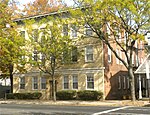
West Rock is a neighborhood of the city of New Haven, Connecticut. The neighborhood is dominated by the southern end of West Rock Ridge State Park. It also contains the campus of Southern Connecticut State University and Common Ground High School. The north end of the official neighborhood contains the Brookside neighborhood. The public housing in the neighborhood has been redeveloped in recent years, after dilapidation and neglect, under the Federal HOPE VI program. These include Brookside, Rockview and Ribicoff (now Twin Brook).For many years, the community was separated from neighboring Hamden, Connecticut by a chain link fence on the Hamden side of the border. The fence was a source of much political and racial conflict between the two municipalities. The neighboring communities and road network are now reconnected.

Excerpt from the Wikipedia article West Rock, New Haven (License: CC BY-SA 3.0, Authors).

West Rock, New Haven
Wintergreen Avenue, New Haven

Geographical coordinates (GPS) Address Nearby Places
placeShow on map

Wikipedia: West Rock, New HavenContinue reading on Wikipedia

Geographical coordinates (GPS)

Latitude Longitude
N 41.3384 ° E -72.9608 °
placeShow on map

Address

Common Ground High School

Wintergreen Avenue
06514 New Haven
Connecticut, United States
mapOpen on Google Maps

Share experience

Nearby Places

Amity (New Haven)

Amity is a residential and commercial neighborhood of the city of New Haven, Connecticut, United States. It is bounded on the northeast by West Rock Ridge, on the south by the Westville neighborhood of New Haven, and on the northwest by the Flats in the town of Woodbridge, Connecticut. The official New Haven neighborhood planning maps include the traditionally separate neighborhoods of West Hills (vicinity of Valley Street) and Beverly Hills (area between Whalley Avenue and Fountain Street) within the Amity neighborhood. The neighborhood lies in the glacier-carved valley of the West River. The river flows in a southerly direction, bisecting the neighborhood. Three primary routes serve Amity: Route 15, also known as the Wilbur Cross Parkway, a limited access highway which has a full interchange numbered as Exit 59 in the neighborhood. Route 63 (Amity Road), which runs northwest–southeast, starting in Amity. Route 69 (Whalley Avenue), originating in Amity and running north–south parallel to the western flank of West Rock Ridge.Located near Amity is the western outlet of the Heroes Tunnel, a twin tunnel which carries the Wilbur Cross Parkway through approximately 1,200 feet (370 m) of solid traprock beneath West Rock Ridge. It is the only tunnel on a limited-access highway in the state of Connecticut. The southbound roadway on the Wilbur Cross Parkway ascends sharply when exiting from the Heroes Tunnel, climbing over 250 feet (76 m) in less than 2 miles (3.2 km), the steepest inclination on any limited-access highway in the State of Connecticut. When travelling northbound on the Wilbur Cross Parkway approaching toward Exit 59, the roadway descends sharply into the valley, offering a scenic vista of the West Rock Ridge, the twin tubes of the Heroes Tunnel, the City of New Haven to the south, and the glacial valley which opens to the north. Amity is home to its namesake Amity Shopping Center, and is located approximately 2 miles (3.2 km) southeast of Amity Regional High School, which serves the neighboring towns of Woodbridge, Bethany, and Orange, Connecticut.

Beaver Hills, New Haven

Beaver Hills is a neighborhood in the city of New Haven, Connecticut. The older, east central portion of the neighborhood is listed on the National Register of Historic Places as the Beaver Hills Historic District. The southwest portion is a state historic district called the Fairlawn-Nettleton Historic District.The name “Beaver Hills” dates to the Colonial era, when it was a piece of high ground near several "beaver ponds". Geologist James Dwight Dana later attributed the "Beaver Pond" to natural springs, rather than the activity of beavers.The Beaver Hills Historic District covers 97 acres (39 ha) of the neighborhood north of Goffe Street and east of Ella Grasso Boulevard. It was listed on the National Register of Historic Places in 1986 and included 235 contributing buildings. The listing recognized the district's significance as a nearly intact example of an early 20th-century suburban residential subdivision. The district in 1986 was composed mostly of single-family homes built between 1908 and 1936. One feature of note was the presence of "one of the city's best collections of early 20th-century garages." The district includes brick gateway piers at the intersections of Goffe Terrace with Norton Parkway and with Ellsworth Avenue, at the south end of the district. The piers include "tile plaques depicting beavers" and "were constructed by the Beaver Hills Company in 1908 to define the southern terminus of the neighborhood." Significant contributing properties in the historic district include the Pitkin House (1931 Tudor Revival style house at 207 Colony Road) and the Alan Krevit House (1936 Colonial Revival style house at 186 Colony Road)