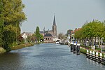
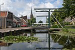
Veur
Former municipalities of South HollandSouth Holland geography stubs

Veur is a former municipality in the Dutch province of South Holland. It covered the northwestern part of the current town of Leidschendam. Veur was a separate municipality between 1817 and 1938, when it merged with Stompwijk to form the new municipality of Leidschendam.
Excerpt from the Wikipedia article Veur (License: CC BY-SA 3.0, Authors, Images).Veur
Stompwijkseweg, Leidschendam-Voorburg
Geographical coordinates (GPS) Address Nearby Places Show on map
Geographical coordinates (GPS)
| Latitude | Longitude |
|---|---|
| N 52.083333333333 ° | E 4.4333333333333 ° |
Address
Stompwijkseweg
Stompwijkseweg
2266 GD Leidschendam-Voorburg
South Holland, Netherlands
Open on Google Maps


