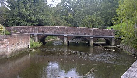
River Wallington

The River Wallington curves and gently meanders west then south in south-east Hampshire. Rising at sources to north and south of Waterlooville these flow west around Portsdown Hill into a dammed section as the lake in the grounds of Southwick House to unite, then through the village of Southwick then, in that parish, to receive the Beck of similar flow from the north. The river turns south and runs past fields and past the large town Fareham, before entering Portsmouth Harbour, as its main natural watercourse inflow, at Wallington.The Beck drains, likewise standard small dendritic drainage sources, at least four in number, and particularly the hamlets of Upper and Lower Beckford in Southwick and Widley civil parish, crossed by Beckford Lane today at Beckford Bridge, a former ford.
Excerpt from the Wikipedia article River Wallington (License: CC BY-SA 3.0, Authors, Images).River Wallington
Wellington Way,
Geographical coordinates (GPS) Address Nearby Places Show on map
Geographical coordinates (GPS)
| Latitude | Longitude |
|---|---|
| N 50.881 ° | E -1.032 ° |
Address
Wellington Way
PO7 7ED
England, United Kingdom
Open on Google Maps


