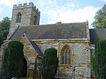
Ravensthorpe, Northamptonshire
Civil parishes in NorthamptonshireUse British English from March 2014Villages in NorthamptonshireWest Northamptonshire District

Ravensthorpe is a village and civil parish in West Northamptonshire in England. The village lies approximately midway between Northampton and Rugby. The M1 motorway is six miles west and the nearest railway station is at Long Buckby. At the time of the 2001 census, the parish's population was 656 people, including Coton but falling slightly to 646 at the 2011 census.The village's name means 'outlying farm/settlement of Hrafn'. Services within the village include a shop, the 'Chequers' pub, a playing field, a small park and a woodland maintained by the Woodland Trust.
Excerpt from the Wikipedia article Ravensthorpe, Northamptonshire (License: CC BY-SA 3.0, Authors, Images).Ravensthorpe, Northamptonshire
Guilsborough Road,
Geographical coordinates (GPS) Address Nearby Places Show on map
Geographical coordinates (GPS)
| Latitude | Longitude |
|---|---|
| N 52.3286 ° | E -1.0256 ° |
Address
Guilsborough Road
Guilsborough Road
NN6 8EW , Ravensthorpe
England, United Kingdom
Open on Google Maps


