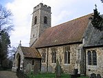
Holverston
Civil parishes in NorfolkNorfolk geography stubsSouth Norfolk
Holverston is a civil parish in the county of Norfolk, England ¾ mile (1¼ km) southeast of Rockland St. Mary. It includes the 16th century Holverston Hall (reached from the A146 between Framingham Pigot and Thurton) and associated barn conversions reached by road from Hellington to the east. In the 2001 census it contained 9 households and a population of 29. All traces of the thatched, round towered church (St. Mary) had disappeared by 1845.
Excerpt from the Wikipedia article Holverston (License: CC BY-SA 3.0, Authors).Holverston
Bullockshed Lane, South Norfolk
Geographical coordinates (GPS) Address Nearby Places Show on map
Geographical coordinates (GPS)
| Latitude | Longitude |
|---|---|
| N 52.577 ° | E 1.407 ° |
Address
Bullockshed Lane
NR14 7HG South Norfolk
England, United Kingdom
Open on Google Maps


