Pocono Mountains

The Pocono Mountains, commonly referred to as the Poconos (), are a geographical, geological, and cultural region in Northeastern Pennsylvania. They overlook the Delaware River and Delaware Water Gap to the east, Lake Wallenpaupack to the north, Wyoming Valley and the Coal Region to the west, and the Lehigh Valley to the south. The name Pocono is derived from the Munsee word Pokawachne, which means "Creek Between Two Hills". Much of the Poconos region lies within the Greater New York–Newark, NY–NJ–CT–PA Combined Statistical Area. The wooded hills and valleys have long been a popular recreation area, accessible within a two-hour drive to millions of metropolitan area residents, with many Pocono communities having resort hotels with fishing, hunting, skiing, and other sports facilities. Although referred to usually as a mountain range, the area is actually a dissected plateau, a sub-section of the larger Allegheny Plateau, forming a 2,400-square-mile (6,200 km2) escarpment. The topological mountains are also a subrange of the Appalachian Mountains.
Excerpt from the Wikipedia article Pocono Mountains (License: CC BY-SA 3.0, Authors, Images).Pocono Mountains
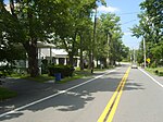
Church Street, Coolbaugh Township
Geographical coordinates (GPS) Address Nearby Places Show on map
Geographical coordinates (GPS)
| Latitude | Longitude |
|---|---|
| N 41.229 ° | E -75.3734 ° |
Address
Church Street
Church Street
18460 Coolbaugh Township
Pennsylvania, United States
Open on Google Maps


