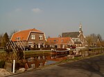
Laagblokland
Former municipalities of South HollandMolenlandenSouth Holland geography stubs
Laagblokland is a former hamlet in the Dutch province of South Holland. It was located in the former municipality of Graafstroom, between the villages of Molenaarsgraaf and Ottoland. Laagblokland was a separate municipality between 1817 and 1857, when it merged with Ottoland.
Excerpt from the Wikipedia article Laagblokland (License: CC BY-SA 3.0, Authors).Laagblokland
Haringweg, Molenlanden
Geographical coordinates (GPS) Address Nearby Places Show on map
Geographical coordinates (GPS)
| Latitude | Longitude |
|---|---|
| N 51.890716 ° | E 4.846687 ° |
Address
Haringweg 3
2975 LB Molenlanden
South Holland, Netherlands
Open on Google Maps


