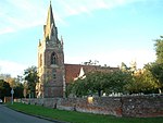
Holybrook
Berkshire geography stubsCivil parishes in BerkshireSuburbs of Reading, BerkshireTilehurstUse British English from May 2017 ... and 1 more
West Berkshire District
Holybrook is a civil parish, forming a contiguous part of Reading in West Berkshire and is a mixture of urban, suburban land with watercourses and flood meadows in Berkshire, England. The parish takes its name from the Holy Brook, a watercourse which forms its southern boundary and which is a corollary of the River Kennet. Its main settlements are part of Calcot those commonly known as Beansheaf Farm and Fords Farm, Holybrook and occasionally considered part of Calcot or Southcote which overlaps with this area.
Excerpt from the Wikipedia article Holybrook (License: CC BY-SA 3.0, Authors).Holybrook
Grangely Close,
Geographical coordinates (GPS) Address Nearby Places Show on map
Geographical coordinates (GPS)
| Latitude | Longitude |
|---|---|
| N 51.439 ° | E -1.038 ° |
Address
Grangely Close
Grangely Close
RG31 7DR , Fords Farm
England, United Kingdom
Open on Google Maps


