place

North Falmouth, Massachusetts

Census-designated places in Barnstable County, MassachusettsCensus-designated places in MassachusettsFalmouth, MassachusettsPopulated coastal places in MassachusettsUse mdy dates from July 2023
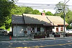
Congregational Church, North Falmouth MA

North Falmouth is a census-designated place (CDP) in the town of Falmouth in Barnstable County, Massachusetts, United States. The population was 3,084 at the 2010 census.

Excerpt from the Wikipedia article North Falmouth, Massachusetts (License: CC BY-SA 3.0, Authors, Images).

North Falmouth, Massachusetts
Wild Harbor Road,

Geographical coordinates (GPS) Address Nearby Places
placeShow on map

Wikipedia: North Falmouth, MassachusettsContinue reading on Wikipedia

Geographical coordinates (GPS)

Latitude Longitude
N 41.644722222222 ° E -70.630555555556 °
placeShow on map

Address

Wild Harbor Road 167
02556
Massachusetts, United States
mapOpen on Google Maps

Congregational Church, North Falmouth MA
Share experience

Nearby Places

Scraggy Neck

Scraggy Neck is a peninsula in Buzzards Bay south of the Cape Cod Canal, in Cataumet, Massachusetts, USA. It is south of Wings Neck and southeast of Bassetts Island. As with all land in the area, the ancestral people on and around Scraggy Neck were Wampanoag. In 1637, through means that are not entirely clear, Thomas Dexter acquired the land that is now Scraggy Neck from the Wampanoag. Around 1667, he transferred the land to the Town of Sandwich and it became "parsonage property" of the First Church, Sandwich Massachusetts. On 9 February 1847 the "First Parish in Sandwich County of Barnstable" transferred title to Martin Ellis for $1,350.In 1866, Ellis offered the property for sale, advertising in the Yarmouth Register "Scraggy Neck for Sale." The ad copy declared "The estate lying in Pocasset (Sandwich)... consisting of 384 acres, principally woodland, cut off in 1846, but with pasture for cattle and sheep, and unrivalled privileges for shell and other fisheries. There are on the premises a dwelling house for a small family, a good barn, and other out-buildings. Also, a thrifty young orchard of apple, pear and quince trees. Making this a very desirable place for farming, sheep raising, or shore fishing. The present proprietor is obliged to give it up on account of ill health. Price $2,000. For further particulars apply to JOSHUA HANDY, near the premises. MARTIN ELLIS" On 3 March 1870, Joshua Handy, on behalf of Ellis, sold the land for $1,000 to Charles W. Parker and George P. Ellis. They subsequently, on 13 May 1870, sold to Washington Allen for $1,600.On 21 April 1892, through a series of transactions between Allen, Francis H. Learned, and Edith H. Eustis, William Ellery Channing ("W.E.C.") Eustis "bought the entire three-hundred-acre, flounder-shaped peninsula" and began developing property on the neck. The total purchase price of the land seems to have been $50,000.In 1937, Edward C. Johnson II and his wife Elsie L. Johnson bought a house on the neck and began a long family association with the area. The Johnson and Eustis families converted the central 75 acres of the island to a protected forest. Current residents of the neck are members of the Scraggy Neck Recreation Association

Bassetts Island

Bassetts Island is a Y-shaped island within Pocasset Harbor and Red Brook Harbor, in Bourne, Massachusetts, USA. 41-40’48” North x 070-38’13” West Is located between two Peninsulas, Wings Neck to the North and Scraggy Neck to the South, and is geographically separated into four portions, the central, northeast, southeast, and the western. The island is approximately 60 acres of woodland, marshland and beach. The island is inhabited year round with one house on the western portion and five houses on the northeastern portion. There are no roads on the island, but with the exception of the southern portion, there is a minor path that runs throughout the island. The island can only be accessed via boat and has no utility services to the island. There are two channels, one on the North Side and one on the South side. The North channel provides access to Pocassett Harbor and the Barlow's Landing Boat Ramp. The South channel provides access to Red Brook Harbor, Kingman Yacht Club, Parker's Boat Yard, Hen Cove and the Hen Cove boat ramp, Hospital Cove and the Red Brook Herring Run. The South Channel be shallow and tight due to a large sand bar that extends from the Southern tip of the island. The Western side of the Southern tip provides great boat accessible swimming and a sandy beach. In contrast, the Eastern side of the Southern tip has rocky beach. Anchorage can be found on the North, East and West sides of the island, but the Westerly anchorage isn't as protected as the other two. During the summer months, the Easterly side of the island is a favorite among locals. The island's history dates back to the mid 1600s when it was owned by William Numuck, a Wampanoag, whom also owned most of Pocasset and Cataumet stretching from the Pocasset River to the Falmouth Town line and also included Numuck's Island (Auntchishogquechike Island).