place

Plym Valley Railway

Geographic coordinate listsHeritage railways in DevonLists of coordinatesStandard gauge railways in EnglandTourist attractions in Plymouth, Devon
Transport in Plymouth, DevonUse British English from May 2017
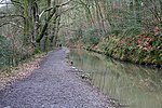
Plymouth, Plym Valley Railway geograph.org.uk 2571020

The Plym Valley Railway is a 1 mile 14 chains (1.9 km) heritage railway based on part of the now-closed South Devon and Tavistock Railway, a branch line of the Great Western Railway in Devon, England. The line originally opened in 1859 and closed in 1962. Heritage first ran in 2001.

Excerpt from the Wikipedia article Plym Valley Railway (License: CC BY-SA 3.0, Authors, Images).

Plym Valley Railway
Plym Valley Trail, Plymouth Leigham

Geographical coordinates (GPS) Address Nearby Places
placeShow on map

Wikipedia: Plym Valley RailwayContinue reading on Wikipedia

Geographical coordinates (GPS)

Latitude Longitude
N 50.395 ° E -4.083 °
placeShow on map

Address

Plym Valley Trail

Plym Valley Trail
PL7 4NW Plymouth, Leigham
England, United Kingdom
mapOpen on Google Maps

Plymouth, Plym Valley Railway geograph.org.uk 2571020
Share experience

Nearby Places

Saltram House
Saltram House

Saltram House is a grade I listed George II era house in Plympton, Devon, England. It was deemed by the architectural critic Pevsner to be "the most impressive country house in Devon". The house was designed by the architect Robert Adam, who altered and greatly expanded the original Tudor house on two occasions. The Saloon is considered one of Adam's finest interiors. Saltram is one of Britain's best preserved examples of an early Georgian house and retains much of its original decor, plasterwork and furnishings. It contains the Parker family's large collection of paintings, including several by Sir Joshua Reynolds (1723-1792), born and educated at Plympton and a friend of the Parker family. The present building was commenced by John Parker (1703–1768) of nearby Boringdon Hall, Plympton, and of Court House, North Molton, both in Devon, together with his wife Catherine Poulett (1706-1758), a daughter of John Poulett, 1st Earl Poulett. It was completed by his son John Parker, 1st Baron Boringdon (1735-1788), whose son was John Parker, 1st Earl of Morley (1772-1840). The Parker family had risen to prominence in the mid-16th century as the bailiff of the manor of North Molton, Devon, under Baron Zouche of Haryngworth.The Saltram Estate was transferred to the National Trust in lieu of death duties in 1957, and is open to the public. Saltram House was used as one of several local settings for the 1995 film Sense and Sensibility.

Laira
Laira

Laira – previously recorded as Lare (1591), Lary poynte (1638), the Leerie (1643), and the Lairy (1802) – was originally the name given to that part of the estuary of the River Plym from the Cattewater up to Marsh Mills in Plymouth, Devon, England. The name may derive from a Brythonic word corresponding to the Welsh llaeru, meaning 'to ebb'.The A379 road and the disused Plymouth to Yealmpton railway line cross the estuary just above the Plymouth suburb of Cattedown by two bridges both known as Laira Bridge. The name Laira now also refers to the area of Plymouth surrounding the Laira Traction Maintenance Depot. Much of the housing here was built around 1900 for employees of the depot. There is a memorial plaque to the men of Laira who died in the Great War along Old Laira Road. Also situated on Old Laira Road is the old Police / Fire Station which is currently used as a library. Laira Green Primary school is situated in the area, as well as a disused United Reformed Church. Until the beginning of the 19th century, Old Laira Road had constituted the northern shore of Lipson Lake (or Bay), an extensive tidal inlet on the western side of the estuary. This area – on which the railway depot and Lipson Co-operative Academy now stand – was reclaimed from the estuary and drained, together with Tothill Bay on the south side of higher ground at Mount Gould, upon the completion in 1802 of an embankment along the whole western shore of the Laira. A new road, laid along this embankment shortly afterwards, from Laira Green to Prince Rock, soon became the main highway into Plymouth from Plympton, Exeter, and beyond, avoiding the often steep and narrow way via Old Laira Road and Lipson – even though the new route was to remain a toll road until 1924.