place

Estover, Plymouth

Devon geography stubsSuburbs of Plymouth, Devon

Estover is a district in Devon, England, within the Plymouth boundary area. The original hamlet was extensively developed during the 1970s, into what became back then a large housing estate, consisting almost entirely of council houses (constructor: Wimpey Homes), situated five miles northeast of Plymouth city centre in the English county of Devon. The majority of the houses are now privately owned. Estover also annexes an industrial estate. It has two schools, Tor Bridge High (formerly Estover Community college) and Tor Bridge Primary, both of which are situated along Miller Way. Estover has one public house, the Jolly Miller. Associated Dairies opened their very first, and large Asda superstore in southern England in Estover in 1976. The industrial estate is home to, amongst others, a Wrigley Company Limited factory.A satellite photo of Estover, provided by Google Maps can be found here.

Excerpt from the Wikipedia article Estover, Plymouth (License: CC BY-SA 3.0, Authors).

Estover, Plymouth
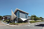
Miller Way, Plymouth Estover

Geographical coordinates (GPS) Address Phone number Website Nearby Places
placeShow on map

Wikipedia: Estover, PlymouthContinue reading on Wikipedia

Geographical coordinates (GPS)

Latitude Longitude
N 50.41 ° E -4.1 °
placeShow on map

Address

Tor Bridge Primary School

Miller Way
PL6 8EE Plymouth, Estover
England, United Kingdom
mapOpen on Google Maps

Phone number

call+441752964010

Website
tbp.timat.co.uk

linkVisit website

Share experience

Nearby Places

Plymouth City Airport

Plymouth City Airport (IATA: PLH, ICAO: EGHD) was an airport located within the City of Plymouth 3.5 NM (6.5 km; 4.0 mi) north northeast of the city centre in Devon, England at Derriford (formerly Roborough). The airport opened on this site in 1925 and was officially opened by the future king Edward VIII, as Prince of Wales, in 1931. The airport is owned by Plymouth City Council and leased to Plymouth-based company Sutton Harbour Holdings. In 2009, 157,933 passengers passed through the airport, a sharp increase of 34.0% on the 2008 total of 117,823 making Plymouth one of the few UK airports experiencing significant growth during the period. However, following the withdrawal of London flights in early 2011, the airport's owners said passenger totals had fallen to fewer than 100 a day. The London Stock Exchange was notified on 28 April 2011 that the airport would close by the end of the year.Plymouth City Airport had a CAA Public Use Aerodrome Licence (Number P687) that allowed flights for the public transport of passengers or for flying instruction, and was part of the Strasser Scheme. The airport closed and ceased all operations on 23 December 2011. Since that time it has been mothballed with the aviation infrastructure and navigation aids retained pending an attempt by the leaseholder to change the use of the site in planning so that it can be disposed of for residential development. As result of the announced closure a group from the Plymouth business community initiated a campaign to protect the airport site. The group known as Viable delivered a petition to the city council with more than 38,000 signatures objecting to the Airport closure and asking the council to protect the site.A full Council debate on the petition concluded with a unanimous vote in support of the airport's retention. There were just two abstentions. Accordingly, in 2014 Plymouth City Council decided to safeguard the site for future general aviation use in the forthcoming Plymouth Plan on the basis of evidence provided in the report on which the council had accepted the airport's closure. Having achieved its campaign objectives, in 2015 Viable wound up its campaign and created FlyPlymouth Ltd with the objective of acquiring and reopening Plymouth airport. FlyPlymouth proposes to operate Plymouth Airport a general and business aviation airport not relying on commercial passenger services, the withdrawal of which led to the airport's closure.