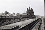
Hackleton
Civil parishes in NorthamptonshireHackletonUse British English from March 2014Villages in NorthamptonshireWest Northamptonshire District

Hackleton is a village located in West Northamptonshire, just north of Buckinghamshire. It is 5 miles (8.0 km) south of Northampton town centre, and 2 miles (3.2 km) by road to the M1 London to Yorkshire motorway junction 15 and 11 miles (18 km) north of junction 14. London is 62 miles (100 km) south via junction 14 and 47 miles (76 km) southeast of Birmingham via junction 15. It lies on the busy B526 road (former A50) from Northampton to Newport Pagnell, between Horton and Wootton. The parish area is about 1,030 acres (420 ha). The villages name means 'Farm/settlement connected with Haeccel'.
Excerpt from the Wikipedia article Hackleton (License: CC BY-SA 3.0, Authors, Images).Hackleton
The Banks,
Geographical coordinates (GPS) Address Nearby Places Show on map
Geographical coordinates (GPS)
| Latitude | Longitude |
|---|---|
| N 52.18879 ° | E -0.82295 ° |
Address
The Banks
The Banks
NN7 2AF , Hackleton
England, United Kingdom
Open on Google Maps


