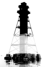
Hart Miller Island
Landforms of Baltimore County, MarylandMaryland islands of the Chesapeake BayRiver islands of MarylandUninhabited islands of Maryland

Hart Miller Island is located at the mouths of Back River and Middle River, where they empty into the Chesapeake Bay east of the City of Baltimore in Maryland. It was formerly two separate islands, Hart Island and Miller Island, but it is now almost entirely artificial. In 1981, the area began being filled with dredged material by the U.S. Army Corps of Engineers, for the purpose of habitat restoration, and the project was completed in 2012. It is now in use as Hart-Miller Island State Park, accessible only by boat.
Excerpt from the Wikipedia article Hart Miller Island (License: CC BY-SA 3.0, Authors, Images).Hart Miller Island
Blue Cross Dike Loop,
Geographical coordinates (GPS) Address Nearby Places Show on map
Geographical coordinates (GPS)
| Latitude | Longitude |
|---|---|
| N 39.251666666667 ° | E -76.373333333333 ° |
Address
Blue Cross Dike Loop
Blue Cross Dike Loop
Maryland, United States
Open on Google Maps


