place

Goat Island (Port Jackson)

1826 establishments in AustraliaBuildings and structures completed in 1826Edmund Blacket buildings in SydneyFormer military installations in New South WalesGardens in New South Wales
Industrial buildings in New South WalesIslands of SydneyMilitary installations established in 1826Museums in New South WalesNew South Wales State Heritage RegisterShipyards of New South WalesSydney HarbourSydney Harbour National ParkSydney localitiesTourist attractions in SydneyUse Australian English from June 2018
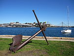
Goat Island and Downtown Sydney

Goat Island is a heritage-listed island located in Port Jackson, in Sydney, New South Wales, Australia. Located north-west of the Sydney central business district, Goat Island is about 300m wide in a north/south direction and 180m long in an east/west direction; and covers an area of 5.4 hectares (13 acres). Goat Island lies off the shores of the Sydney suburbs of Balmain and Millers Point, at the junction of Darling Harbour with the main channel of Sydney Harbour. The island is a former gunpowder storage, arsenal, bacteriology station, shipyard, powder magazine, maintenance facility and accommodation and now interpretation centre and education facility. Over the years Goat Island has served as a quarry, convict stockade, explosives store, police station, fire station, boatyard and film set. Today the island forms part of the Sydney Harbour National Park. The built facilities on the island were designed by Edmund Blacket and Alexander Dawson and built from 1826 to 1994. Goat Island is also known as Memel or Me-Mel, meaning the eye. The property is owned by the NSW Office of Environment and Heritage, an agency of the Government of New South Wales. It was added to the New South Wales State Heritage Register on 2 April 1999.

Excerpt from the Wikipedia article Goat Island (Port Jackson) (License: CC BY-SA 3.0, Authors, Images).

Goat Island (Port Jackson)
Clifton Lane, Sydney Balmain East

Geographical coordinates (GPS) Address Nearby Places
placeShow on map

Wikipedia: Goat Island (Port Jackson)Continue reading on Wikipedia

Geographical coordinates (GPS)

Latitude Longitude
N -33.8521 ° E 151.1966 °
placeShow on map

Address

Clifton Lane Steps

Clifton Lane
2041 Sydney, Balmain East
New South Wales, Australia
mapOpen on Google Maps

Goat Island and Downtown Sydney
Share experience

Nearby Places

Balls Head Bay

Balls Head Bay, formerly known as Oyster Cove, Wollstonecraft Bay, Sugarworks Bay, Powder Works Bay and Kerosene Bay, is a bay located to the west of the Waverton Peninsula, west of Balls Head and to the east of Berry Island, on the north of Sydney Harbour, Sydney, New South Wales, Australia.Some of the older alternative names for the bay refer to industries that were once situated on its foreshore. There was a sugar factory, Robey's Sugar Works, there from around 1857 to 1859. There was a facility that produced kerosene from oil shale and handled imported 'case oil', Australian Mineral Oil Company, there from 1865 to 1868. There was an explosives factory, Neokratine Safety Explosives Company, there from 1889 to 1891. The site of these earlier enterprises was later occupied by a gasworks owned by the North Shore Gas Company, from 1917 to 1987. After coal gas production ceased, during the period 1971–1973, the artist Brett Whitely used the disused coal store building as a studio for creating large artworks. The site is now the residential complex, 'Wondakiah', with some public open space. Some of the old gasworks buildings have been repurposed as part of the residential complex.Balls Head Bay contains the former Balls Head Coal Loader. Parts of the disused loader site have been converted to public space—now known as the Coal Loader Centre for Sustainability—with the derelict loading wharf remaining safely off-limits. The site has interpretive signage that provides information covering in detail the history of the site. In June 2021, the coal loader site was added to the NSW Heritage Register. It is now the home of the museum and training ship MV Cape Don. The naval base HMAS Waterhen is located within the bay.Ships were broken up and burnt to the waterline in the bay. One such ship was the Lalla Rookh, which was broken up at Kerosene Bay in 1898 after it caught fire in November 1897. The Australasian Underwater Cultural Heritage Database describes her as a 147-ton brig, 29.9 metres (98 ft) long. (See Lalla Rookh (ship).)