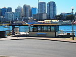
Blues Point
McMahons PointSydney geography stubsSydney localities

Blues Point is a harbourside locality of North Sydney, Australia. Named after local mariner Billy Blue in the 19th century, Blues Point is at the very southern tip of the McMahons Point peninsula and has views of Sydney Harbour. The locality, within North Sydney Council, is home to the Blues Point Tower, a controversial residential tower designed by Harry Seidler. Since 2005, under the dual naming policy Blues Point has also been officially referred to by its indigenous name, Warungareeyuh. Blues Point is also used as a vantage point for Sydney's New Year's Eve celebration.
Excerpt from the Wikipedia article Blues Point (License: CC BY-SA 3.0, Authors, Images).Blues Point
Blues Point Road, Sydney McMahons Point
Geographical coordinates (GPS) Address Nearby Places Show on map
Geographical coordinates (GPS)
| Latitude | Longitude |
|---|---|
| N -33.8497 ° | E 151.2035 ° |
Address
Blues Point Tower
Blues Point Road
2060 Sydney, McMahons Point
New South Wales, Australia
Open on Google Maps


