Beltinge
Herne Bay, KentKent geography stubs
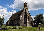
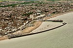
Beltinge is a low cliff-top suburb of Herne Bay in Kent, England. It forms the easternmost part of the urban area of Herne Bay and is just west of the small settlement of Reculver, which had an important Roman Fort and a channel which served to provide safer passage around what was the 'Isle of Thanet' until the early Middle Ages.
Excerpt from the Wikipedia article Beltinge (License: CC BY-SA 3.0, Authors).Beltinge
Reculver Road, Canterbury Beltinge
Geographical coordinates (GPS) Address Nearby Places Show on map
Geographical coordinates (GPS)
| Latitude | Longitude |
|---|---|
| N 51.37216 ° | E 1.16007 ° |
Address
Reculver Road
Reculver Road
CT6 6ND Canterbury, Beltinge
England, United Kingdom
Open on Google Maps


