A299 road
Geographic coordinate listsInfobox road instances in the United KingdomInfobox road maps tracking categoryLists of coordinatesRoads in Kent ... and 1 more
Use British English from February 2013

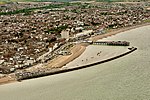
The A299, better known as the Thanet Way, is a major road of 22 miles (35 km) in the county of Kent, England, and runs from Brenley Corner near Faversham (where it merges into the M2) to Ramsgate via Whitstable and Herne Bay. The road provides access for freight traffic to Ramsgate Harbour, Manston Airport and Thanet Earth, as well as local access to Thanet.
Excerpt from the Wikipedia article A299 road (License: CC BY-SA 3.0, Authors, Images).A299 road
Thanet Way, Canterbury Talmead
Geographical coordinates (GPS) Address Nearby Places Show on map
Geographical coordinates (GPS)
| Latitude | Longitude |
|---|---|
| N 51.3607 ° | E 1.1527 ° |
Address
Thanet Way
Thanet Way
CT6 6LB Canterbury, Talmead
England, United Kingdom
Open on Google Maps


