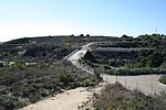
La Habra Heights, California

La Habra Heights is a city in Los Angeles County, California, United States. The population was 5,325 at the 2010 census, down from 5,712 at the 2000 census. La Habra Heights is a suburban canyon community located on the border of Orange and Los Angeles counties. The zoning is 1-acre (4,000 m2) lots with a variety of home and ranch style properties. La Habra Heights features open space and there are no sidewalks in the community. La Habra Heights has no commercial activity (stores, gas stations) with the exception of a small real estate office, a plant nursery, a private golf course and numerous home-based businesses. Hacienda Park is the main park in the city and runs along Hacienda Road. A related city, La Habra, is located south of La Habra Heights and is in Orange County.
Excerpt from the Wikipedia article La Habra Heights, California (License: CC BY-SA 3.0, Authors, Images).La Habra Heights, California
Greenview Road,
Geographical coordinates (GPS) Address Nearby Places Show on map
Geographical coordinates (GPS)
| Latitude | Longitude |
|---|---|
| N 33.963888888889 ° | E -117.95277777778 ° |
Address
Greenview Road
Greenview Road
90631 , La Habra Heights
California, United States
Open on Google Maps


