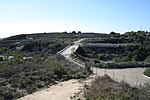
Rancho La Habra
1839 establishments in MexicoCalifornia ranchosRanchos of Los Angeles County, CaliforniaRanchos of Orange County, CaliforniaSan Gabriel Valley
Rancho La Habra (also called "Rancho Cañada de La Habra") was a 6,698-acre (27.11 km2) Mexican land grant in present-day Los Angeles County and Orange County, California given in 1839 by Governor Juan Alvarado to Mariano Reyes Roldan. The name refers to the "Pass Through the Hills", the natural pass to the north between the Chino Hills and Puente Hills into the San Gabriel Valley, first discovered by Spanish explorers in 1769. The La Habra grant was shaped like a wedge pointed south. The rancho lands included the present day cities of La Habra and La Habra Heights.
Excerpt from the Wikipedia article Rancho La Habra (License: CC BY-SA 3.0, Authors).Rancho La Habra
Avocado Crest Road,
Geographical coordinates (GPS) Address Nearby Places Show on map
Geographical coordinates (GPS)
| Latitude | Longitude |
|---|---|
| N 33.95 ° | E -117.96 ° |
Address
Avocado Crest Road
Avocado Crest Road
90631 , La Habra Heights
California, United States
Open on Google Maps


