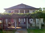
Hacienda Heights, California
1913 establishments in CaliforniaCensus-designated places in Los Angeles County, CaliforniaCommunities in the San Gabriel ValleyHacienda Heights, CaliforniaPages including recorded pronunciations ... and 1 more
Puente Hills

Hacienda Heights (pronunciation) is an unincorporated suburban community in Los Angeles County, California, United States. As of the 2010 census, the community had a total population of 54,038, up from 53,122 at the 2000 census. For statistical purposes, the Census Bureau has defined Hacienda Heights as a census designated place (CDP). It is the second largest CDP in Los Angeles County by area, behind Topanga, and the county's fourth largest CDP by population.
Excerpt from the Wikipedia article Hacienda Heights, California (License: CC BY-SA 3.0, Authors, Images).Hacienda Heights, California
Farmstead Avenue, El Monte Hacienda Heights
Geographical coordinates (GPS) Address Nearby Places Show on map
Geographical coordinates (GPS)
| Latitude | Longitude |
|---|---|
| N 34.000555555556 ° | E -117.96944444444 ° |
Address
Farmstead Avenue
Farmstead Avenue
91745 El Monte, Hacienda Heights
California, United States
Open on Google Maps


