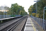
Leigh, Kent
Civil parishes in KentSevenoaks DistrictVillages in Kent

Leigh , historically spelled Lyghe, is a village and a civil parish located in the Sevenoaks district of Kent, England. It is located six miles (10 km) south of Sevenoaks town and three miles (5 km) west of Tonbridge. There is a large village green; nearby is Hall Place, once Leigh Hall, occasionally open to the public, built in 1876. The parish church (13th century) is dedicated to St Mary.
Excerpt from the Wikipedia article Leigh, Kent (License: CC BY-SA 3.0, Authors, Images).Leigh, Kent
Barnetts Road,
Geographical coordinates (GPS) Address Nearby Places Show on map
Geographical coordinates (GPS)
| Latitude | Longitude |
|---|---|
| N 51.196 ° | E 0.22 ° |
Address
Barnetts Road
Barnetts Road
TN11 8QH , Leigh
England, United Kingdom
Open on Google Maps


