place

Haisthorpe

AC with 0 elementsEast Riding of Yorkshire geography stubsOpenDomesdayUse British English from December 2014Villages in the East Riding of Yorkshire
Woldgate Methodist Church Haisthorpe

Haisthorpe is a village in the East Riding of Yorkshire, England. It is situated approximately 4 miles (6 km) south-west of Bridlington town centre. It lies on the A614. The village forms part of the civil parish of Carnaby. In the village, to the north of the A614, is Grade II listed late 18th-century Haisthorpe Hall.In 1823 Haisthorpe (then Haysthorp), was in the civil parish of Burton Agnes and the Wapentake of Dickering. Population at the time was 109, with occupations that included four farmers, a shoemaker, and a butcher.

Excerpt from the Wikipedia article Haisthorpe (License: CC BY-SA 3.0, Authors, Images).

Geographical coordinates (GPS)

Latitude Longitude
N 54.065151 ° E -0.278929 °
placeShow on map

Address

Haisthorpe Main Road

Main Road
YO25 4NT , Carnaby
England, United Kingdom
mapOpen on Google Maps

Woldgate Methodist Church Haisthorpe
Share experience

Nearby Places

Carnaby, East Riding of Yorkshire

Carnaby is a small village and civil parish on the A614 road in the East Riding of Yorkshire, England. It is situated approximately 2 miles (3 km) south-west of Bridlington town centre. The civil parish is formed by the villages of Carnaby and Haisthorpe and the hamlet of Wilsthorpe. According to the 2011 UK Census, Carnaby parish had a population of 415, an increase on the 2001 UK Census figure of 300.From the mediaeval era until the 19th century Carnaby was part of Dickering Wapentake. Between 1894 and 1974 Carnaby was a part of the Bridlington Rural District, in the East Riding of Yorkshire. Between 1974 and 1996 it was part of the Borough of North Wolds (later Borough of East Yorkshire), in the county of Humberside. The church dedicated to St John the Baptist was designated a Grade II* listed building in 1966 and is now recorded in the National Heritage List for England, maintained by Historic England.During the Second World War, Carnaby Aerodrome served as an emergency landing site for crippled planes. Specially built to cater for stricken aircraft, the airfield had an extra large runway, 9,000 feet (2.7 km) in length and 700 feet (210 m) wide. The airfield also operated a fog dispersion system, nicknamed FIDO. After the war, the site was used to store Thor IRBM Missiles. The airfield finally closed in 1963 and is now an industrial estate, a large source of employment for the local area. Carnaby railway station on the Yorkshire Coast Line from Hull to Scarborough served the village until it closed on 5 January 1970. However, people can still travel to Hull, Bridlington, Driffield and Scarborough by using the EYMS bus route number '121' that has alternative bus times.In 1974, the Satra Motors Car Importation and Preparation Centre was opened at Carnaby, upgrading imported Russian built Lada and Moskvich cars for British showrooms. Although Moskvich had stopped importing cars to Britain by the end of the 1970s, Lada continued until July 1997, when it withdrew from Britain, sparking the closure of the Satra centre. Carnaby Temple, an octagonal folly stands in fields about 1 mile (1.6 km) north of Carnaby. It was built by Sir George Strickland, owner of Boynton Hall, in 1770 and is locally known as 'The Pepperpot'. The structure is based on the Tower of the Winds which is on the Roman Agora in Athens. In 1952 it was given Grade II listed building status.

Burton Agnes
Burton Agnes

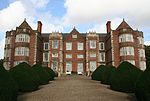
Burton Agnes (named after Agnes de Percy) is a village and civil parish in the East Riding of Yorkshire, England. It is situated on the A614 road midway between Driffield and Bridlington. Local landmarks include an Elizabethan manor house, Burton Agnes Hall, and a Norman manor house, Burton Agnes Manor House. Both buildings are recorded in the National Heritage List for England, maintained by Historic England as Grade I listed. The church, dedicated to St Martin, was designated as Grade I listed in 1966.The civil parish is formed by the village of Burton Agnes and the hamlets of Gransmoor and Thornholme. According to the 2011 UK Census, Burton Agnes parish had a population of 497, an increase of one over the 2001 UK Census figure.From the mediaeval era until the 19th century Burton Agnes was part of Dickering Wapentake. Between 1894 and 1974 Burton Agnes was a part of the Bridlington Rural District, in the East Riding of Yorkshire. Between 1974 and 1996 it was part of the Borough of North Wolds (later Borough of East Yorkshire, in the county of Humberside. Burton Agnes holds an annual Scarecrow Festival during which the village is decorated with scarecrows. The festival began in 2004 and was devised by a group of children to raise money.Burton Agnes primary school is on Rudston Road, also on which are playing fields, close to the cemetery. The playing fields are the base for football and cricket teams. There is a small bowls field near the football pitch. Bridlington Archery Club also uses the facility. Burton Agnes railway station on the Yorkshire Coast Line from Hull to Scarborough served the village until it closed on 5 January 1970.On 17 September 1947 a truck carrying German prisoners of war was in collision with a train at the Burton Agnes level crossing killing two British and ten German soldiers. On 23 December 2013 a plaque was unveiled at the site of the crash in remembrance those who died.