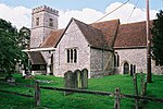
Buttermere, Wiltshire
Civil parishes in WiltshireEngvarB from August 2019OpenDomesdayVillages in Wiltshire

Buttermere is a small village and civil parish on the eastern boundary of Wiltshire, England, about 4.5 miles (7 km) south of Hungerford and 10 miles (16 km) southeast of Marlborough. The village stands above the steep escarpment of Ham Hill, and at 257 metres (843 ft) above sea level it is the highest village in Wiltshire and probably the highest in Wessex. The parish includes the hamlet of Henley, southwest of Buttermere village and next to the county border with Hampshire, and the western flanks of Inkpen Hill.
Excerpt from the Wikipedia article Buttermere, Wiltshire (License: CC BY-SA 3.0, Authors, Images).Buttermere, Wiltshire
Church Lane,
Geographical coordinates (GPS) Address Nearby Places Show on map
Geographical coordinates (GPS)
| Latitude | Longitude |
|---|---|
| N 51.347 ° | E -1.511 ° |
Address
Church Lane
SN8 3RQ
England, United Kingdom
Open on Google Maps


