Les Baux-de-Provence

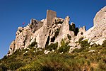
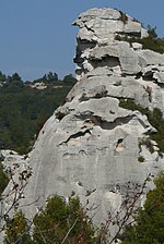
Les Baux-de-Provence (French pronunciation: [le bo də pʁɔvɑ̃s]; lit. "Les Baux of Provence"; Provençal: Lei Bauç de Provença (classical norm) or Li Baus de Prouvènço (mistralian norm)), commonly referred to simply as Les Baux, is a rural commune in the Bouches-du-Rhône department in the Provence-Alpes-Côte d'Azur region in Southern France. It is located in the Alpilles mountains, northeast of Arles, atop a rocky outcrop that is crowned with a ruined castle overlooking the plains to the south. Its name refers to its site: in Provençal, bauç is a rocky spur. From the village name the word bauxite was coined for aluminium ore when first discovered there by geologist Pierre Berthier in 1821. Until 13 August 1958, the commune was officially named La Baux.Renamed after the historical province of Provence, it is considered one of the most beautiful villages in France and has over 1.5 million visitors per year although it has only about 20 residents in the upper part of the commune and 315 (as of 2020) for the whole commune. Inhabitants of the commune are known as Baussencs (masculine) and Baussenques (feminine) in French. The commune is part of Alpilles Regional Natural Park.
Excerpt from the Wikipedia article Les Baux-de-Provence (License: CC BY-SA 3.0, Authors, Images).Les Baux-de-Provence
Grand Rue, Arles
Geographical coordinates (GPS) Address Nearby Places Show on map
Geographical coordinates (GPS)
| Latitude | Longitude |
|---|---|
| N 43.7439 ° | E 4.7953 ° |
Address
Mairie des Baux
Grand Rue 29
13520 Arles
Provence-Alpes-Côte d'Azur, France
Open on Google Maps


