place

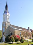
Beth Jacob Congregation (Mendota Heights, Minnesota)

Conservative synagogues in Minnesota

Beth Jacob Congregation is a Conservative Jewish synagogue located in Mendota Heights, Minnesota, United States. It was founded in 1985 and has a membership of 400 families. Beth Jacob is a community of Jews who come together to nurture relationships with God and each other. It is a Conservative synagogue that values Torah (study), Avodah (reverential service) and Gemilut Hasadim (acts of loving kindness). Men, women and children have equal opportunity to be part of the community.

Excerpt from the Wikipedia article Beth Jacob Congregation (Mendota Heights, Minnesota) (License: CC BY-SA 3.0, Authors).

Beth Jacob Congregation (Mendota Heights, Minnesota)
Victoria Curve,

Geographical coordinates (GPS) Address Phone number Website Nearby Places
placeShow on map

Wikipedia: Beth Jacob Congregation (Mendota Heights, Minnesota)Continue reading on Wikipedia

Geographical coordinates (GPS)

Latitude Longitude
N 44.885 ° E -93.151388888889 °
placeShow on map

Address

Beth Jacob Congregatoin

Victoria Curve 1179
55118
Minnesota, United States
mapOpen on Google Maps

Phone number

call+16514522226

Website
beth-jacob.org

linkVisit website

Share experience

Nearby Places

Minnesota River
Minnesota River

The Minnesota River (Dakota: Mnísota Wakpá) is a tributary of the Mississippi River, approximately 332 miles (534 km) long, in the U.S. state of Minnesota. It drains a watershed of 14,751 square miles (38,200 km2) in Minnesota and about 2,000 sq mi (5,200 km2) in South Dakota and Iowa. It rises in southwestern Minnesota, in Big Stone Lake on the Minnesota–South Dakota border just south of the Laurentian Divide at the Traverse Gap portage. It flows southeast to Mankato, then turns northeast. It joins the Mississippi at Mendota south of the Twin Cities of Minneapolis and St. Paul, near the historic Fort Snelling. The valley is one of several distinct regions of Minnesota. The name Minnesota comes from the Dakota language phrase, "Mnisota Makoce" which is translated to "land where the waters reflect the sky", as a reference to the many lakes in Minnesota rather than the cloudiness of the actual river. At times, the native variant form "Minisota River" is used. For over a century prior to the organization of the Minnesota Territory in 1849, the name St. Pierre (St. Peter) had been generally applied to the river by French and English explorers and writers. Minnesota River is shown on the 1757 edition of Mitchell Map as "Ouadebameniſsouté [Watpá Mnísota] or R. St. Peter". On June 19, 1852, acting upon a request from the Minnesota territorial legislature, the United States Congress decreed the aboriginal name for the river, Minnesota, to be the river’s official name and ordered all agencies of the federal government to use that name when referencing it. The valley that the Minnesota River flows in is up to five miles (8 km) wide and 250 feet (80 m) deep. It was carved into the landscape by the massive glacial River Warren between 11,700 and 9,400 years ago at the end of the last ice age in North America. Pierre-Charles Le Sueur was the first European known to have traveled along the river. The Minnesota Territory, and later the state, were named for the river.

Acacia Park Cemetery, Mendota Heights

Acacia Park Cemetery is a public cemetery on Oheyawahi-Pilot Knob hill, in Mendota Heights, Minnesota. Established in 1925, Acacia Park consists of 75 acres (300,000 m2) of land overlooking the confluence of the Minnesota and Mississippi Rivers. Prior to acquisition by European settlers, Dakota people used the site as a sacred meeting place and burial ground. The cemetery was founded when Twin Cities members of the Masonic order purchased 125 acres (51 ha) of land at Pilot Knob, Mendota Heights. It was originally intended for the exclusive use of Masons and their families, and the name of the cemetery derives from the acacia sprig used in Masonic burial rituals. Plans for the cemetery included a temple burial chapel, administration buildings, a 65 ft (20 m) monolith, and landscaping (which included removal of 20 feet from the top of the "knob"). Consistent with Masonic tradition, the graves were marked with only a simple, uniform slab bearing the deceased person's name with birth and death dates. The cemetery was officially opened on October 10, 1928 with a dedicatory speech by Minnesota governor Theodore Christianson.In the 1970s, the cemetery was opened to general public use.During the lifetime of the cemetery, skeletal remains have been uncovered; some of these remains were stored in a vault at the cemetery. In 2016, the co-mingled remains in the vault were examined at Hamline University and found to include individuals of both Native American and European background, demonstrating that the site has been important in rituals of both communities.