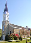
Acacia Park Cemetery, Mendota Heights

Acacia Park Cemetery is a public cemetery on Oheyawahi-Pilot Knob hill, in Mendota Heights, Minnesota. Established in 1925, Acacia Park consists of 75 acres (300,000 m2) of land overlooking the confluence of the Minnesota and Mississippi Rivers. Prior to acquisition by European settlers, Dakota people used the site as a sacred meeting place and burial ground. The cemetery was founded when Twin Cities members of the Masonic order purchased 125 acres (51 ha) of land at Pilot Knob, Mendota Heights. It was originally intended for the exclusive use of Masons and their families, and the name of the cemetery derives from the acacia sprig used in Masonic burial rituals. Plans for the cemetery included a temple burial chapel, administration buildings, a 65 ft (20 m) monolith, and landscaping (which included removal of 20 feet from the top of the "knob"). Consistent with Masonic tradition, the graves were marked with only a simple, uniform slab bearing the deceased person's name with birth and death dates. The cemetery was officially opened on October 10, 1928 with a dedicatory speech by Minnesota governor Theodore Christianson.In the 1970s, the cemetery was opened to general public use.During the lifetime of the cemetery, skeletal remains have been uncovered; some of these remains were stored in a vault at the cemetery. In 2016, the co-mingled remains in the vault were examined at Hamline University and found to include individuals of both Native American and European background, demonstrating that the site has been important in rituals of both communities.
Excerpt from the Wikipedia article Acacia Park Cemetery, Mendota Heights (License: CC BY-SA 3.0, Authors, Images).Acacia Park Cemetery, Mendota Heights
Pilot Knob Road,
Geographical coordinates (GPS) Address Nearby Places Show on map
Geographical coordinates (GPS)
| Latitude | Longitude |
|---|---|
| N 44.878194 ° | E -93.170199 ° |
Address
Pilot Knob Road 2229
55120
Minnesota, United States
Open on Google Maps


