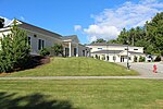
Dartmouth–Lake Sunapee Region
New Hampshire geography stubsRegions of New HampshireTourism regions of New Hampshire

The Dartmouth–Lake Sunapee area of the U.S. state of New Hampshire lies in the west-central portion of the state, along the Connecticut River Valley. It includes all of Sullivan County, and parts of Merrimack County and Grafton County. The region shares its name with Dartmouth College, a prestigious Ivy League institution, and Lake Sunapee, a popular tourist destination. Interstate 89 forms the main freeway connecting the region to other parts of New Hampshire, as well as to nearby Vermont. Lebanon, Hanover, and Claremont are the three most populous communities in the region.
Excerpt from the Wikipedia article Dartmouth–Lake Sunapee Region (License: CC BY-SA 3.0, Authors, Images).Dartmouth–Lake Sunapee Region
NH 10,
Geographical coordinates (GPS) Address Nearby Places Show on map
Geographical coordinates (GPS)
| Latitude | Longitude |
|---|---|
| N 43.489166666667 ° | E -72.1375 ° |
Address
NH 10
03753
New Hampshire, United States
Open on Google Maps


