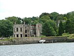
Llangwm, Pembrokeshire
Communities in PembrokeshirePages with Welsh IPAVillages in Pembrokeshire

Llangwm (; Welsh pronunciation: [ˈɬangʊm]) is a small village, parish and community of around 450 properties situated on the Llangwm Pill off the River Cleddau estuary near Haverfordwest, Pembrokeshire, Wales. It has a history of mining and fishing and is in the largely English-speaking south of the county.
Excerpt from the Wikipedia article Llangwm, Pembrokeshire (License: CC BY-SA 3.0, Authors, Images).Llangwm, Pembrokeshire
Pill Parks Way,
Geographical coordinates (GPS) Address Nearby Places Show on map
Geographical coordinates (GPS)
| Latitude | Longitude |
|---|---|
| N 51.747 ° | E -4.912 ° |
Address
Pill Parks Way
Pill Parks Way
SA62 4HT , Llangwm
Wales, United Kingdom
Open on Google Maps


