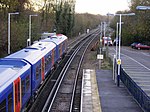
Holybourne
EngvarB from June 2016Villages in Hampshire

Holybourne is a village in the East Hampshire district of Hampshire, England. It is 1.3 miles (2.2 km) northeast of the centre of Alton, is contiguous with it and shares its A31 bypass. The nearest railway station also being in Alton. The village has a population of around 1,500 and is where Treloar School is located. Holybourne has a pub – The White Hart – and a small store.
Excerpt from the Wikipedia article Holybourne (License: CC BY-SA 3.0, Authors, Images).Holybourne
London Road, East Hampshire
Geographical coordinates (GPS) Address Website Nearby Places Show on map
Geographical coordinates (GPS)
| Latitude | Longitude |
|---|---|
| N 51.163 ° | E -0.95 ° |
Address
Friends At The Lawn
London Road 119
GU34 4ER East Hampshire
England, United Kingdom
Open on Google Maps


