place

Benickebrinken

Streets in Stockholm
Benicke 1865 A O Mankell

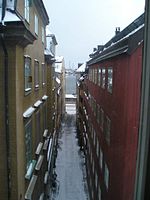
Södra/Norra Benickebrinken are two sloping streets in Gamla stan, in the old town in central Stockholm, Sweden, stretching from Österlånggatan up to Svartmangatan.

Excerpt from the Wikipedia article Benickebrinken (License: CC BY-SA 3.0, Authors, Images).

Benickebrinken
Svartmangatan, Stockholm Gamla stan (Södermalms stadsdelsområde)

Geographical coordinates (GPS) Address Nearby Places
placeShow on map

Wikipedia: BenickebrinkenContinue reading on Wikipedia

Geographical coordinates (GPS)

Latitude Longitude
N 59.323444444444 ° E 18.073527777778 °
placeShow on map

Address

Svartmangatan

Svartmangatan
111 31 Stockholm, Gamla stan (Södermalms stadsdelsområde)
Sweden
mapOpen on Google Maps

Benicke 1865 A O Mankell
Share experience

Nearby Places

Pelikansgränd
Pelikansgränd

Pelikansgränd is an alley in Gamla stan, the old town of Stockholm, Sweden, connecting Gaffelgränd to Österlånggatan. It forms a parallel street to Ferkens Gränd, Lilla Hoparegränd, Gaffelgränd, and Johannesgränd. The alley appears in historical records as Lilla S:t Johannes gränd in 1664, Pilicans Gränden around 1700, and Pelekans gr[änd] in 1733. In the basement of the building still present on 39, Österlånggatan, constructed by a man named Hans Georg Cron who bought the site in 1664, was an inn called Pelikan ("Pelican"), an establishment which gave its name to both the building and the street. A noteworthy portal of historical interest is found on number 3.Like most of the structures along the eastern waterfront, the buildings in the alley were built on garbage and landfills, and, as unveiled in connection with excavations in the 1940s and 1950s, 5–6 metres long poles pushed vertically through the layers during the 15th century, are today leaning some 20 degrees towards the water, thus indicating the area have been sliding eastward by some 2–3 metres and sinking by at least 1.5 metres.The oldest archaeological traces underlying the area are the remains of a landing stage found close to today's Österlånggatan, revealing that it was first settled in the late-13th and early-14th centuries. The oldest historical evidence mentions two stone houses on Österlånggatan flanking an alley leading down to a bulwark by the water demolished in 1430. The location of the bulwark can still be seen at the border between the properties south of the alley.An archaeological investigation in 1997–1998, showed the storehouse on number 1 dates from 1700, and the building east of it probably from the same period.

Tyska Skolgränd
Tyska Skolgränd

Tyska Skolgränd (Swedish: German School Alley) is an alley in Gamla stan, the old town in central Stockholm, Sweden, stretching from Svartmangatan to Baggensgatan, and crossed by Själagårdsgatan. The present name of the street, first appeared as Tyska Scholæ Gatan on a map from the early 18th century. It is apparently derived from the German school in the late 16th century housed on number 8, Själagårdsgatan. The lot was thereafter bought by the German parish who had a first school building built in 1626, and a new completed in 1670. The building was subsequently enlarged and rebuilt on several occasions, the present buildings mostly date from 1887. The building, as it seem, was the one in general used by itinerant theatre groups in Stockholm during the 17th century. The German school was discontinued after more than 300 years, but a new German school, still in operation, was inaugurated on Östermalm in 1941.The part of the alley east of Själagårdsgatan appears under different names reflecting the various activities dominating it: In 1557, it is called Tynnebindare gaten referring to a cooper (e.g. maker of barrels) Peder Tunnbindare ("Peter Barrel-binder") known to have lived here in 1538. Located on the north side of the alley was, however, the potent Vårfrugillet av den tyska nationen ("Our Lady's guild of the German Nation"), which gave the alley the name Gillestugegaten ("Guild's Cottage's Street") in 1579. During the 18th century, the alley is also referred to as Persiljegränd ("Parsley Alley"), possibly a corruption (jocular or not) of the name of the extended block east of the alley, Perseus. Since the revision of street names in 1885, this alley is, however, made part of the western section. Over the porch of Number 4 is a sandstone cartouche dating back to the 1670s and displaying the message: "dVM sChoLa teVton ICI CoetVs eXstrVCta VIgesCIt, eXsVrget StVdIIs gLorIa IVsta pIIs"a Latin sentence meaning "As long as the school of the German parish prosper, conscientious studies will bring true honour". The Latin numbers in the sentence - an encrypted message - summon up to the year 1670. This street also appears on the cover art for Dakara Boku wa Ongaku wo Yameta (だから僕は音楽を辞めた), the third studio album in the discography of Japanese rock group ‘Yorushika’