place

Queen Victoria Village

Edwardian architecture in AustraliaMelbourne City CentreShopping centres in MelbourneShopping malls established in 2003Tourist attractions in Melbourne
Use Australian English from March 2015
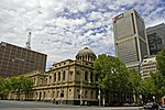
Melbourne QV Village 2008

Queen Victoria Village, generally known as QV Melbourne or just QV, is a precinct in the central business district of Melbourne, Victoria, Australia. Covering the city block bounded by Lonsdale, Little Lonsdale, Swanston, and Russell Streets, and located directly opposite the State Library of Victoria and Melbourne Central, QV comprises a large shopping centre, a central plaza, an underground food court, Melbourne central city's first full-size supermarket and apartment buildings. QV takes its name from the Queen Victoria Hospital, Melbourne which formerly occupied the site.

Excerpt from the Wikipedia article Queen Victoria Village (License: CC BY-SA 3.0, Authors, Images).

Queen Victoria Village
Albert Coates Lane, Melbourne Melbourne

Geographical coordinates (GPS) Address Website External links Nearby Places
placeShow on map

Wikipedia: Queen Victoria VillageContinue reading on Wikipedia

Geographical coordinates (GPS)

Latitude Longitude
N -37.8107 ° E 144.9652 °
placeShow on map

Address

QV

Albert Coates Lane
3000 Melbourne, Melbourne
Victoria, Australia
mapOpen on Google Maps

Website
qv.com.au

linkVisit website

linkWikiData (Q7270550)
linkOpenStreetMap (109230467)

Melbourne QV Village 2008
Share experience

Nearby Places

Caledonian Lane, Melbourne

Caledonian Lane is a street in Melbourne. It is a short, quiet and narrow (4 metre wide) open laneway, running between Little Bourke Street and Lonsdale Street in the central business district of Melbourne. Caledonian Lane is most notable as the former home to the St Jerome's Laneway Festival. It is also notable due to controversial developments in 2009 involving the redevelopment of the Post Office precinct and Department Store precinct also involving the shutting down of both St Jerome's and the festival. A consortium involving Myer and Colonial First State applied for exemption from the City of Melbourne Heritage Overlay to widen the lane by 4 metres to improve access for delivery trucks and in the process demolish the Art Deco Lonsdale House in 2009. Permission was granted by both the City of Melbourne and the State planning minister Justin Madden MP on 24 July 2009 under controversial circumstances. In response to the demolition for the sake of lane widening, a preservation group called Save Lonsdale House formed in late 2009. Until 2004, Caledonian Lane was home to a number of small independent store owners, however the buildings were sold under vacant possession in 2007. The lane is bitumen with a small strip blue stone cobbled gutter, has street lighting attached to Lonsdale House and is by both pedestrian and vehicular traffic, mainly delivery trucks. Caledonian Lane forms a vista toward both Loudon Place to the south and Drewery Lane to the north, both are almost directly opposite.